It's due to arrive Wednesday, Jan. 25, and could deliver more snow across interior areas, but also perhaps even closer to the I-95 corridor, unlike the first storm this week, according to AccuWeather.com.
The currently projected timing for the system has it moving from west to east starting in the middle of the afternoon on Wednesday, according to the National Weather Service.
As of now, there's the potential for up to 2 inches or so of accumulation in Central Park, which, if it happens, would be the first measurable snowfall of the 2022-23 season in New York City.
Similar to the storm Sunday, Jan. 22 into Monday, Jan. 23, parts of upstate New York and northern New England could see between 6 and 12 inches of snowfall from the second system.
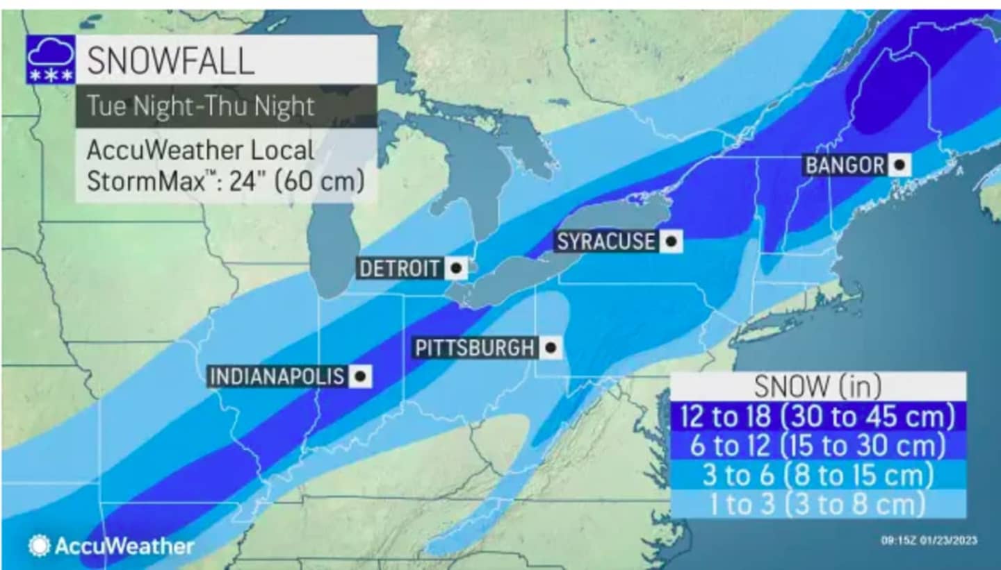
For the first projected snowfall totals for the storm see the image above:
- 1 to 3 inches (sky blue),
- 3 to 6 inches (Columbia blue),
- 6 to 12 inches (blue),
- 12 to 18 inches (royal blue).
In advance of the storm, skies will gradually become clear Monday evening, leading to a mainly sunny and brisk day on Tuesday, Jan. 24, with a high temperature in the low to mid 40s, with wind-chill values in the 20s.
This continues to be a developing story. Check back to Daily Voice for updates.
Click here to follow Daily Voice Ramapo and receive free news updates.