"Conditions over the next few days will be reminiscent of mid-January," said AccuWeather Meteorologist Randy Adkins.
Sunday, March 27 will be partly sunny and blustery with a high temperature in the low 40s. Scattered afternoon showers are possible, with areas farthest north and inland seeing a wintry mix and light snow.
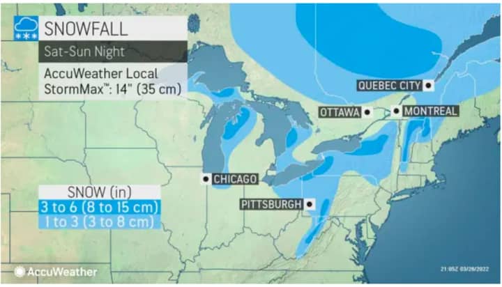
See the first image above for areas where accumulating snow is expected in upstate New York and northern New England on Sunday, with 1 to 3 inches marked in light blue and 3 to 6 inches in Columbia blue.
Wind gusts of 25 miles per hour or more will make it feel like it's in the 20s during the day and between 5 and 15 degrees overnight on Sunday.
For a look at Sunday's wind-chill values, click on the second image above.
Monday, March 28 will be mostly sunny and blustery, with a high around 30 degrees, but wind speeds around 15 miles per hour with gusts up to 30 mph will make it feel like it's in the teens.
Check back to Daily Voice for updates.
Click here to follow Daily Voice Ramapo and receive free news updates.


