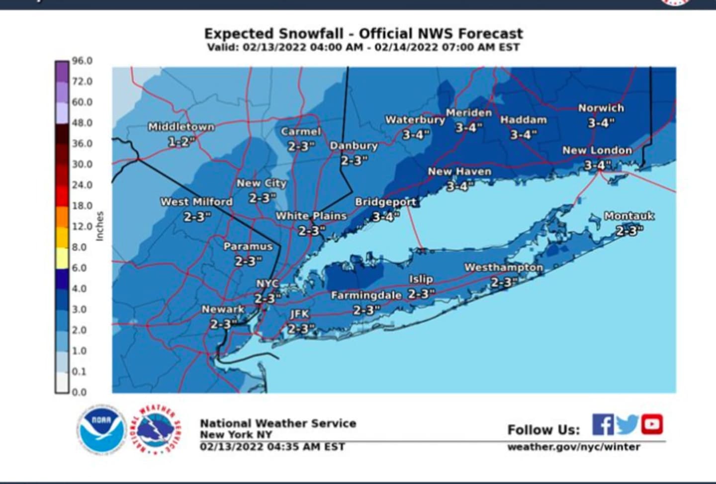

For look at the latest snowfall projections for the storm on Super Bowl Sunday, Feb. 13, click on the first and second images above from the National Weather Service.
Much of the area is now expected to see around 3 inches, with as much as 4 inches in some spots, according to projections in the first image above just released on Sunday morning by the National Weather Service.
Snowfall is expected mainly farthest south in the region.
The storm system is expected to wind down from south to north starting around noontime on Sunday, according to the National Weather Service.
The storm's arrival has been marked by a big change in the form of a dramatic drop in temperatures.
Sunday's high temperature will struggle to reach the freezing mark with wind-chill values between 20 and 25 degrees.
The overnight low temperature Sunday night into Monday morning, Feb. 14 will fall to the mid teens with wind-chill values in the single digits.
Monday will be mostly sunny and cold, with a high temperature in the mid 20s, and Valentine's Day evening will be clear and cold, with the overnight low falling into the teens.
Check back to Daily Voice for updates.
Click here to follow Daily Voice Putnam and receive free news updates.