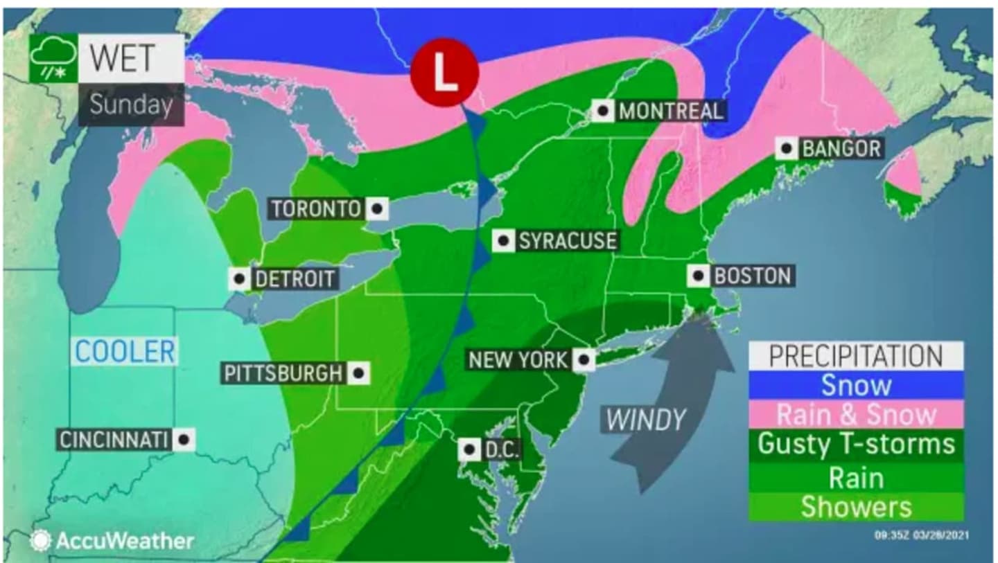
The time frame for precipitation is from late Sunday morning, March 28 to late in the evening Sunday, but the strong winds will last through Monday, March 29 as a cold front pushes through.
A Wind Advisory starts after nightfall on Sunday and is in effect until Monday night.
"A line of showers and embedded thunderstorms approaching into this evening ahead of a cold front has some potential to produce isolated damaging wind gusts," the National Weather Service said in a statement released Sunday morning.
"Gusty winds could blow around unsecured objects. Tree limbs could be blown down and a few power outages may result."
Winds will be out of the west 1at 5 to 25 miles per hour with the isolated gusts up to 50 mph.
Sunday's high temperature will be in the upper 50s.
Up to three-quarters to nearly 1.5 inches of rain is possible before the precipitation winds down late Sunday night.
The storm will lead to a drop in temperatures overnight, with the low around 40 degrees.
Monday will be sunny and breezy with a high temperature of around 50 degrees and the strong, gusty winds continuing through just after nightfall.
Tuesday, March 30 will be sunny with a high temperature in the upper 50s and calmer winds.
Check back to Daily Voice for updates.
Click here to follow Daily Voice Pleasantville and receive free news updates.