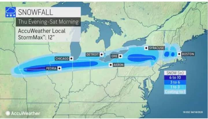
A storm that has brought heavy snow over the Rockies will move into the Northeast toward the end of the week, bringing accumulating snowfall in areas farthest north in the region.
All this comes after an unusually mild winter that saw just a few inches of snowfall accumulation in February and March combined for most of the region.
The timing for the storm is overnight Friday, April 17 into Saturday, April 18.
Areas shown in the image above north of I-84 in New York and Connecticut in light blue could see between 1 to 3 inches with up 3 to 6 inches possible in the areas in blue. Areas in gray could see some slippery road conditions with a trace to an inch of accumulation possible.
In those areas, snowfall will change to rain after 9 a.m. Saturday as the high temperature starts to climb to around 50 degrees.
In areas south of I-84, precipitation will be all rain for the duration of the storm as the temperature holds steady overnight Friday into Saturday around 40 degrees.
Click here to follow Daily Voice Pelham and receive free news updates.


