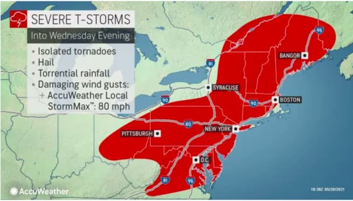
It lasts until late in the evening on Wednesday, May 26.
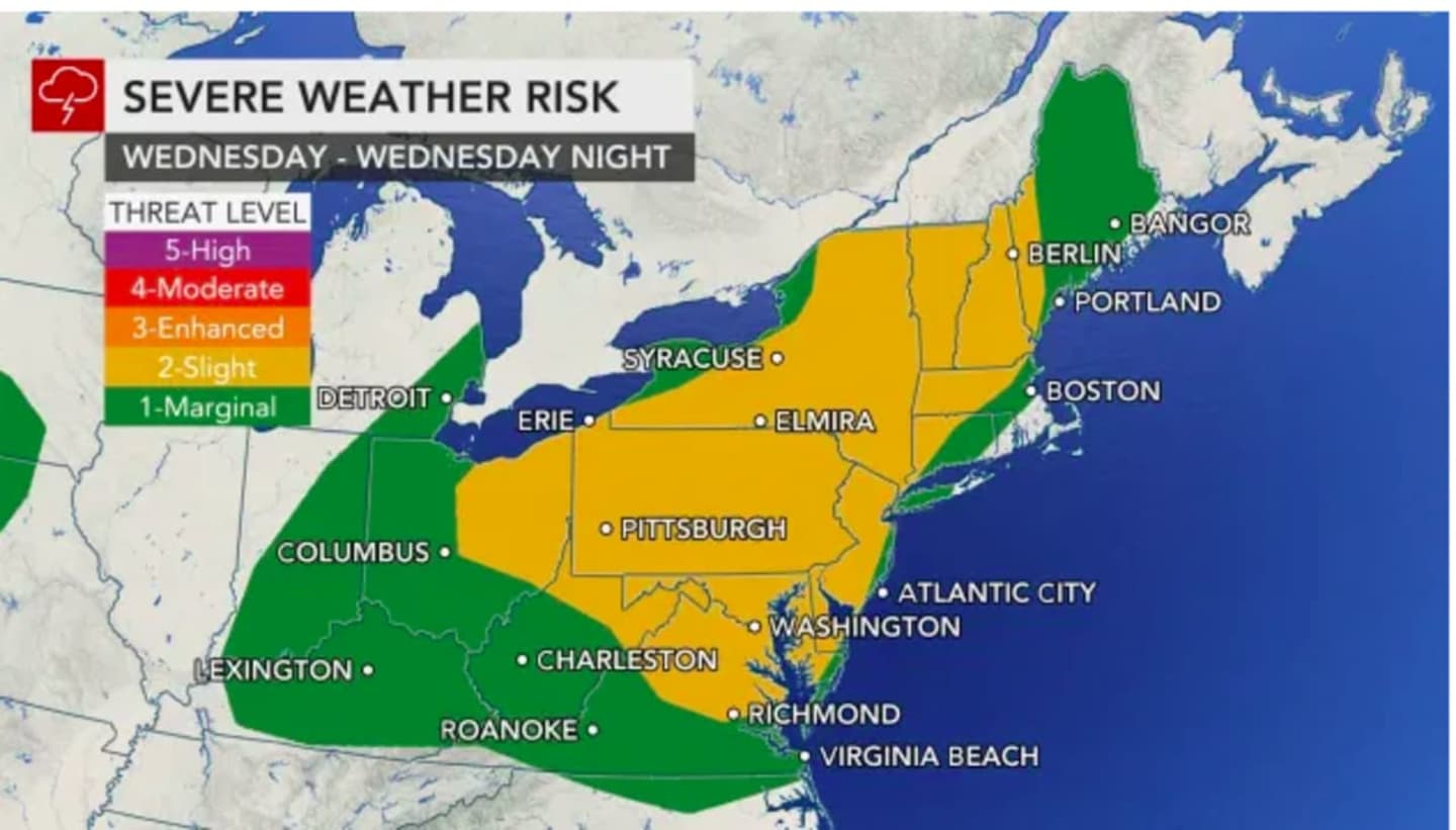
"An approaching cold front will bring potential for scattered strong to severe thunderstorms this afternoon into this evening," the National Weather Service said in a statement accompanying the alert. "Strong to damaging wind gusts will be the main threat. Hail and even an isolated tornado is also a possibility."
Torrential rainfall is possible during storm activity.
It will remain warm Thursday, May 27 with the high temperature in the low 80s with plenty of sunshine.
Temps will fall for the start of the Memorial Day weekend, with the high temperature Friday, May 28 only in the upper 60s with partly sunny skies to start, followed by a chance of rain and showers in the late afternoon into the evening.
Check back to Daily Voice for updates.
Click here to follow Daily Voice Pelham and receive free news updates.