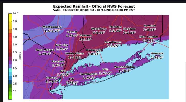
A Flood Watch that includes Westchester, Putnam, Rockland, Dutchess and Orange counties issued by the National Weather Service is in effect until 1 p.m. Saturday.
Localized dense fog is occurring with quick changes in visibility.
Rainfall amounts of 1 to 3 inches with potentially locally higher amounts, the weather service said. (See projections in image above.)
The combination of melting snow and periods of rain should allow rivers and streams to rise, breaking up the ice, and potentially allowing ice jams to form. Rivers and streams could see sudden rises in the vicinity of these ice jams, the weather service added.
Saturday's high temperature will be in the low 40s.
After the storm system moves through, temperatures will drop dramatically. Sunday's high will be in the mid 20s with mostly sunny skies.
Check back to Daily Voice for updates.
Click here to follow Daily Voice Pelham and receive free news updates.

