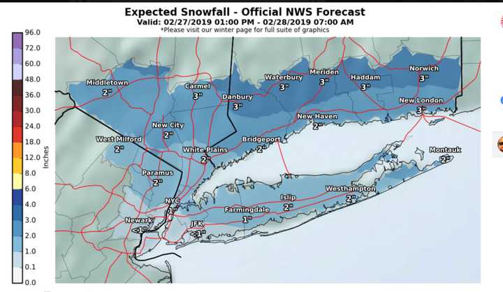
Those conditions will allow for two separate snow events, with the first on Wednesday, Feb. 27 into Thursday, Feb. 28.
Clouds will increase Wednesday morning on a day in which the high temperature will be in the upper 20s with a wind-chill factor of between 10 and 20 degrees.
Snow looks to arrive sometime between this late afternoon and early evening across the region.
The steadiest snow will occur Wednesday evening and should end by sunrise on Thursday. Most of the area will see about 2 to 3 inches of accumulation in total. (See the latest project snowfall totals in the first image above.)
Thursday, Feb. 28 will be partly sunny with a high in the mid 30s.
Friday, March 1 will be mostly cloudy with a high in the upper 30s. There's a chance of snow overnight Friday into Saturday, March 2. It's too early to project possible snowfall amounts for that storm system.
Check back to Daily Voice for updates.
Click here to follow Daily Voice Pelham and receive free news updates.
