Here's what to expect through the end of the week:
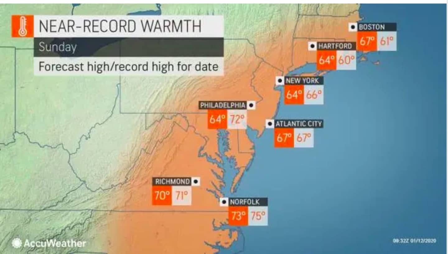
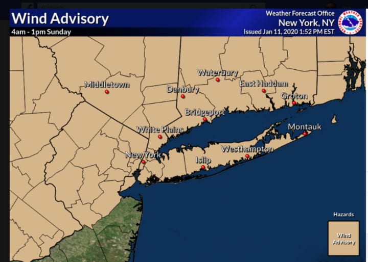
Sunday, Jan. 12: Gradual clearing will continue throughout the day following the round of moderate to heavy rain early in the morning as the high temperature hits the low to mid 60s. A Wind Advisory remains in effect until 1 p.m. Sunday, with wind gusts up 50 miles per hour expected, and some scattered power outages possible.
There will be a drop in temperatures overnight as the cold front arrives late Sunday night, with the overnight low dipping to around 32 degrees.
Monday, Jan. 13: It will be partly sunny with a high temperature in the mid 40s, but the wind-chill value will make it feel like it's between 25 and 35. It will be partly cloudy overnight with the low temperature just above the freezing mark.
Tuesday, Jan. 14: Clouds will increase during the morning and there will be a chance for rain after 1 p.m. and continuing through the evening. The afternoon high temperature will be in the low to mid 40s and the overnight low will be in the mid to upper 30s.
Wednesday, Jan. 15: Mostly sunny and a bit warmer with the high temperature likely to nudge above the 50-degree mark. Clouds will increase in the afternoon and there will be a chance for showers through the evening and rain overnight.
Thursday, Jan. 16: It will be a breezy day with a chance of more rain through late in the morning before becoming partly sunny with a high temperature in the low 40s.
Friday, Jan. 17: Sunny and colder with the high temperature just below the freezing mark.
Saturday, Jan. 18: There is a chance for snow overnight and throughout the morning on Saturday. The high temperature is expected to climb into the upper 30s in the afternoon, with a chance for rain after noontime. It's too early to predict possible snowfall accumulations.
Check back to Daily Voice for updates.
Click here to follow Daily Voice Peekskill and receive free news updates.