Any could become the next named tropical storm. The next name on the list, following the now-departed Henri, is Ida, followed by Julian and Kate.
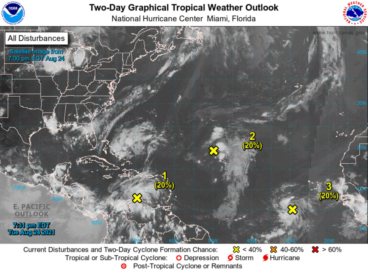
The first is a broad area of low pressure that's expected to form over the southwestern Caribbean Sea from a tropical wave currently located over the central Caribbean Sea. (See the image above.)
"Environmental conditions are forecast to be conducive for development of the low if it remains over water, and a tropical depression could form late this week or this weekend," the National Hurricane Center said.
The second is a broad trough of low pressure that's producing disorganized showers and thunderstorms over the central tropical Atlantic about 1,000 miles east-northeast of the northern Leeward Islands.
"This feature has the best chance to evolve into a tropical depression or storm in the next 48 hours, but it is entrenched in dry, dusty air, which will inhibit tropical development," AccuWeather Senior Meteorologist Alex Sosnowski said.
The third is a tropical wave over the far eastern tropical Atlantic located several hundred miles southwest of the Cabo Verde Islands producing a concentrated area of showers and thunderstorms.
Check back to Daily Voice for updates.
Click here to follow Daily Voice Orangetown and receive free news updates.