
Early Thursday morning, Sept. 5, the eye of the hurricane, now back to Category 3 status, was about 60 miles south of Charleston, South Carolina, moving north at about 10 miles per hour off the coast with high winds of 115 mph.
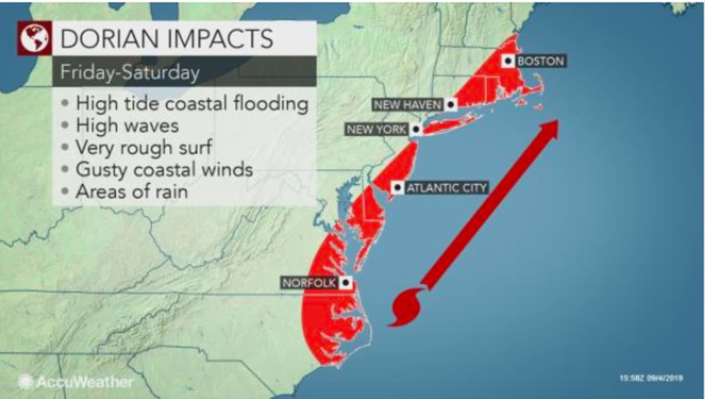
While the New York metropolitan area won't feel the true wrath of the storm, Dorian will bring rain, gusty winds, coastal flooding, high tide, rough surf and high waves to the areas shown in the first image above.
Thursday, Sept. 5 will be pleasant, with partly sunny skies and a high temperature in the low 70s.
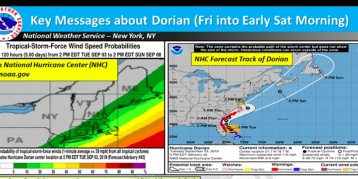
The entire area is expected to see rainfall of up to 1 inch with wind gusts up to 25 to 35 mph near and along the coast on Friday, Sept. 6. (See the second image above.)
Rain will arrive Friday mainly after 3 p.m. on a mostly cloudy day with a high temperature around 70 degrees. Wind speed will be between 8 and 14 mph with much higher gusts.
The storm is expected to finally push off the east coast early Saturday, Sept. 7, which will be partly sunny with a high temperature in the mid 70s.
For the latest projected track and time frame for Dorian, released Thursday morning by the National Hurricane Center, check the third image above.
Check back to Daily Voice for updates.
Click here to follow Daily Voice North Rockland and receive free news updates.