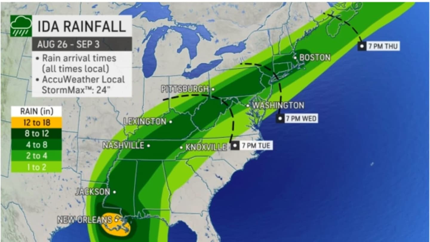


The time frame for rainfall from Ida is Wednesday afternoon, Sept. 1 through Thursday afternoon, Sept. 2.
Leading up to that, Ida will continue to produce heavy rainfall while tracking inland through the Southeast United States, eventually crossing the Appalachians, then off of the Mid-Atlantic Coast on Thursday.
Ida, the ninth-named storm of the 2021 Atlantic season, remained a Category 4 hurricane for hours after making landfall on Sunday afternoon, Aug. 29.
Now Tropical Storm Ida is expected to slowly move north and then northeast during the week, with its remnants arriving in this region on Wednesday, Sept. 1.
"While it might be hard to find the center of Ida by the middle of the week, the transported tropical moisture will likely enhance rainfall from the Ohio Valley to the East Coast," AccuWeather Senior Meteorologist Dan Pydynowski said.
Widespread rainfall amounts of 3 to 4 inches are now projected for most of the region, with locally higher amounts.
"This rainfall combined with wet antecedent conditions may lead to flash flooding," the National Weather Service said in a Hazardous Weather Outlook statement issued Tuesday morning, Aug. 31. "Flooding of fast-responding rivers and streams is possible, and flooding of main stem rivers cannot be ruled out."
- For projected rainfall amounts for Hurricane Ida, click on the first two images above.
- Click on the third and fourth images above for areas most at risk for flash flooding.
- For Ida's projected path, click on the fifth image above.
- For a look at the levels of impact of Ida by region, click on the sixth image above.
This continues to be a developing story. Check back to Daily Voice for updates.
Click here to follow Daily Voice North Rockland and receive free news updates.