

Say goodbye to Henri and Ida.
There's now a brand-new system, the sixth named storm of the 2021 hurricane season that's headed north.
Hello, Larry.
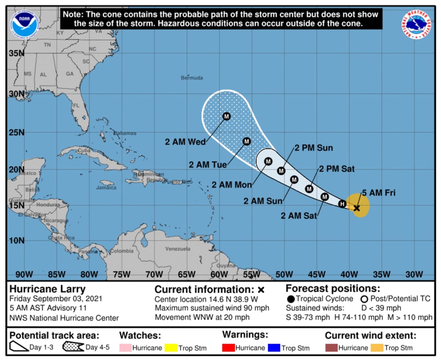
On Friday morning, Sept. 3, the center of the storm is located in the eastern Atlantic Ocean basin (west of the southernmost Cabo Verde Islands and east of the Leeward Islands) with maximum sustained winds of 90 miles per hour and higher gusts.
It should strengthen into a major hurricane by Friday afternoon, and even reach Category 4 status, according to AccuWeather, as it heads north-northwest. (For the latest projected path, click on the first two images above.)
But there's good news. For now at least, long-term projections have Larry being a so-called, "Fish Storm," meaning it should stay off the coast and at sea.
"A strong jet stream across the northern US will likely prevent Larry from ever reaching the US mainland," according to AccuWeather.
But there's still uncertainty surrounding its path.
Check back to Daily Voice for updates.
Click here to follow Daily Voice North Rockland and receive free news updates.