


Ida is moving through the central Appalachians as it heads northward, with an enhanced risk of tornadoes across parts of the mid-Atlantic on Wednesday, Sept. 1.
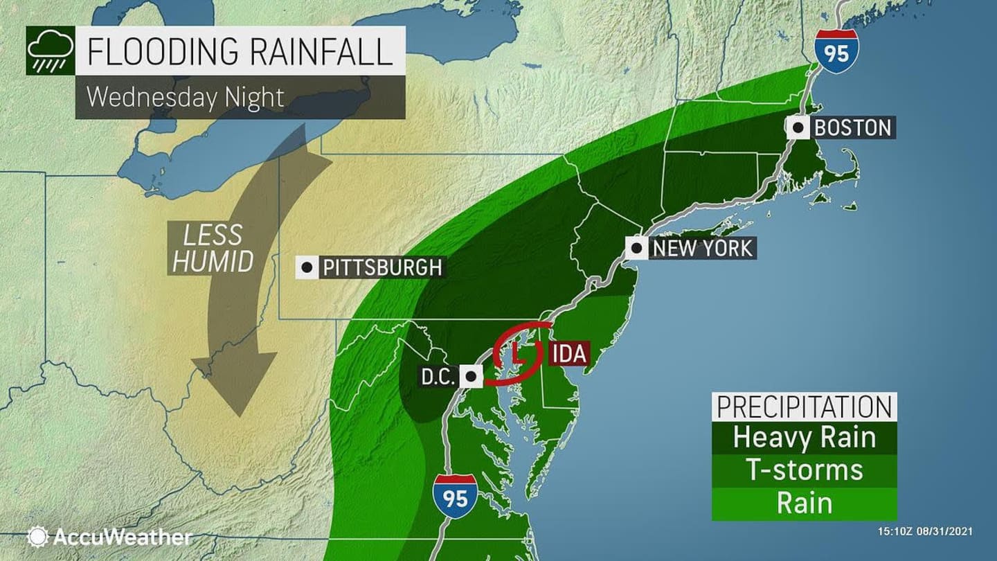
Significant and life-threatening flash flooding is likely from the Mid-Atlantic into southern New England, especially across highly urbanized metropolitan areas and areas of steep terrain, the National Hurricane Center said.
In addition, there will be potential for thunderstorms late Wednesday afternoon into Wednesday evening in the region, some of which may become severe with damaging winds, the National Weather Service said in a Hazardous Weather Outlook statement.
A brief isolated tornado cannot be ruled out, the statement said.
Flash flood watches are in effect for most of the region until 2 p.m. Thursday, Sept. 2.
Widespread rainfall amounts of 3 to 4 inches are now projected for most of the region, with locally higher amounts.
Scattered power outages are possible, especially for areas near the coast.
Ida, the ninth-named storm of the 2021 Atlantic season, remained a Category 4 hurricane for hours after making landfall on Sunday afternoon, Aug. 29. It is soon projected to be a post-tropical cyclone.
- For projected rainfall amounts for Hurricane Ida, click on the second and third images above.
- Click on the fourth image above for areas most at risk for flash flooding.
- For Ida's projected path, click on the fifth image above.
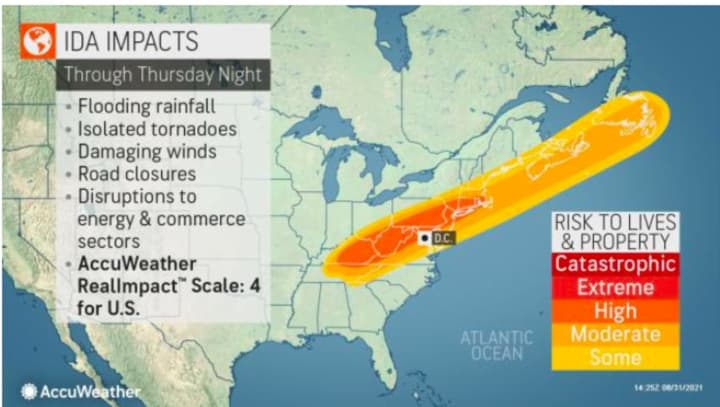
- For a look at the levels of impact of Ida by region, click on the sixth image above.
This continues to be a developing story. Check back to Daily Voice for updates.
Click here to follow Daily Voice North Rockland and receive free news updates.