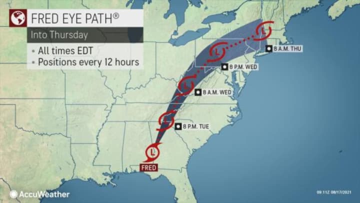
The time frame for the main brunt of storm activity in the area will be Wednesday night, Aug. 18 into around noontime Thursday, Aug. 19.
For a look at the latest projected track and timing for Fred, see the first image above.
The highest chance for flooding will be to the north and west. (Click on the second image above.)
Generally, 1 to 2 inches of rainfall is now expected in this area, with locally higher amounts possible.
Wednesday will be cloudy with a high temperature of around 80 degrees with showers and thunderstorms possible starting late in the morning and then continuing throughout the day and into the overnight.
Some of the storms will produce downpours overnight Wednesday and then at times Thursday, especially in the morning.
Skies will finally begin to clear on Friday, Aug. 20, which will be partly sunny and warmer with a high temperature in the mid 80s. There will still be a chance of showers and storms, however, mainly in the morning.
Check back to Daily Voice for updates.
Click here to follow Daily Voice New Rochelle and receive free news updates.


