


"Ahead of the storm, milder air and a lot of moisture will surge northward along with gusty winds," AccuWeather Meteorologist Jessica Storm said. "The storm will tap into all this moisture to spread drenching rain across a large swath of the East."
A new round of snowfall is possible before the late-week storm with light snow possible any time between around 9 p.m. Monday, Dec. 21 into around 9 a.m. Tuesday, Dec. 22. Little to no accumulation is expected.
Monday will be mostly cloudy with a high temperature in the upper 30s.
Tuesday will gradually become partly sunny with a high temperature in the low 40s.
Ahead of the arrival of the storm, Wednesday, Dec. 23 will be mostly sunny with the high temperature in the upper 30s.
Thursday will be cloudy and warmer, with the high temperature in the low 50s.
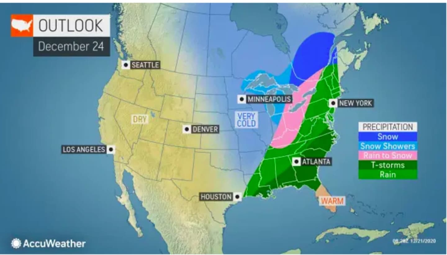
Showers will become likely after noontime Thursday. It will be very windy with periods of rain throughout the day and evening. (See the first image above.)
The combination of rain and snowmelt may lead to flooding, the National Weather Service said. (See the second image above.)
Locally damaging wind gusts will bring the risk of power outages on Christmas Eve into Christmas Day morning. (See the first third above.)
More showers are likely at times until noontime on Christmas, followed by a chance of rain and light snow. (See the fourth image above.)
It will gradually become partly sunny in the afternoon with a high temperature around 40.
There will be a chance for snow showers Christmas evening, mainly before midnight.
The overnight low temperature will drop into the mid 20s, leading to a much colder day on Saturday, Dec. 26, which will be mostly sunny with the high temperature in the low 30s.
There is still some uncertainty surrounding the strength and track of the storm system.
Check back to Daily Voice for updates.
Click here to follow Daily Voice Nassau and receive free news updates.