There will be a respite from the wet weather on Thursday, Oct. 28 with partly cloudy skies, a high temperature in the mid 50s, and calm winds.
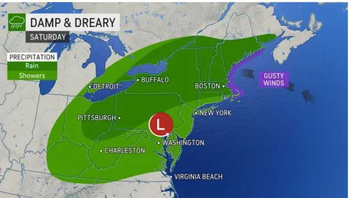
A large area of low pressure is then forecast to shift from the central United States across the Northeast, according to the National Weather Service.
After a partly sunny start on Friday, Oct. 29, clouds will increase during the afternoon on a day in which the high temperature will be around 50 degrees.
Rain will arrive right after nightfall on Friday, and conditions will become blustery, with gusts as high as 30 miles per hour.
Up to an inch of new rainfall is possible by daybreak on Saturday, Oct. 30.
Rain will continue Saturday morning into the afternoon with another three-quarters of an inch to one inch of rain possible, bringing the potential for a total of 2 inches of rain from the new system.
"Even though the storm is forecast to keep moving steadily along, it will tend to pivot over the region as it weakens," said AccuWeather Senior Meteorologist Alex Sosnowski.
As a result, some parts of the region will see "much heavier, drenching periods of rain for a time," according to AccuWeather.
After the rain tapers off by late Saturday afternoon, there will be scattered showers through the early evening hours.
Saturday's high temperature will be around 60 degrees.
The outlook for Halloween on Sunday, Oct. 31 calls for partly sunny skies and a high temperature in the low 60s.
A week later, at 2 a.m. Sunday, Nov. 7, it will be time to “fall back” one hour with the end of Daylight Saving Time.
Check back to Daily Voice for updates.
Click here to follow Daily Voice Mt. Kisco and receive free news updates.
