
A Winter Storm Warning is now in effect from 2 p.m. Wednesday, Dec. 16 through 1 p.m. Thursday, Dec. 17.
Snowfall is expected to become widespread sometime around 5 p.m. Wednesday with the heaviest snow from the storm coming Wednesday night through around midnight Thursday.
Lighter snow will then continue through late Thursday morning. That will be followed by scattered flurries Thursday afternoon before skies become partly sunny before nightfall on Thursday.
Travel could be very difficult to impossible during much of that time frame, the National Weather Service said in a Hazardous Weather Outlook statement on the powerful Nor'easter issued early Wednesday morning. If you must travel, keep an extra flashlight, food, and water in your vehicle in case of an emergency, the statement said.
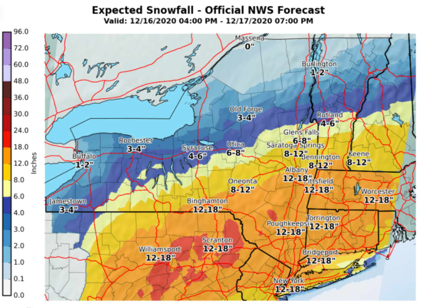
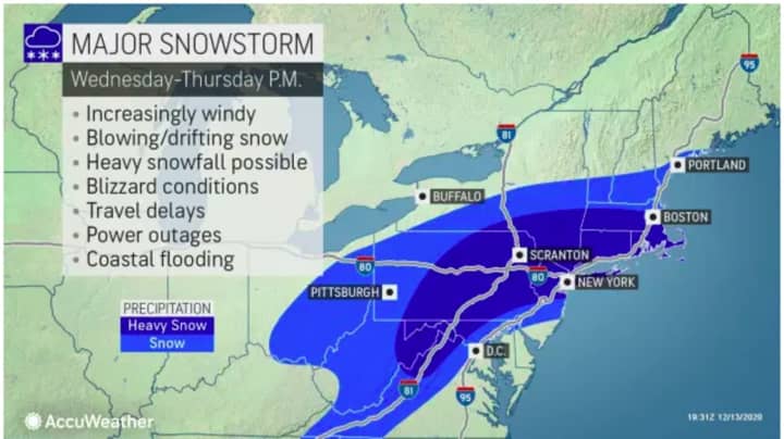
Generally, total snow accumulations of 12 to 16 inches are now expected for most of the region, according to the latest forecast released by the National Weather Service on Wednesday morning. See the first image above. For updated snowfall predictions from AccuWeather, see the second image above.
There remains uncertainty for Long Island, as anticipated mixing of precipitation is expected to lessen totals, especially on Eastern Long Island, with snowfall totals ranging from 2 to 11 inches, depending on the location.
In areas seeing the heaviest snow, near-blizzard conditions are possible at times, with strong winds, blowing and drifting snow, and scattered power outages. (See the third image above.)
This continues to be a developing story. Check back to Daily Voice for updates.
Click here to follow Daily Voice Mount Pleasant and receive free news updates.