Phil saw his shadow on Groundhog Day earlier this month, predicting six more weeks of winter.
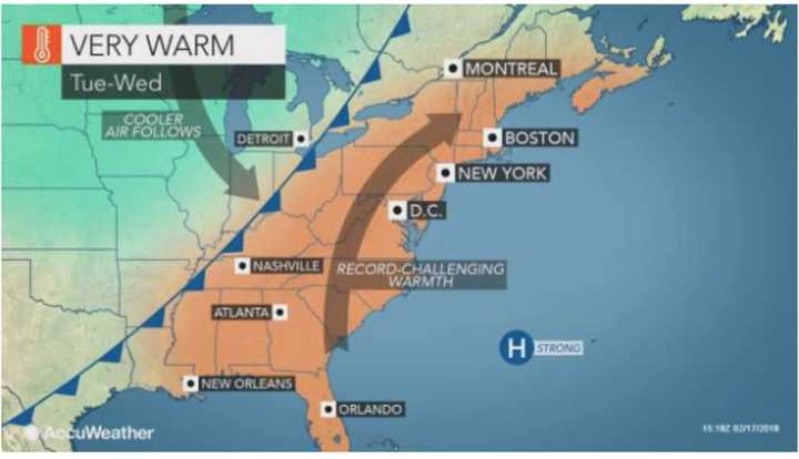
But just a week and a half after making that call, a warm front bringing spring-like warmth to the area will be arriving in the area.
Temperatures on Tuesday are forecast to reach the upper 60s in the tristate area and in the 70s farther south.
Any snow from the weekend storm that did result in more than 6 inches of accumulation for much of the area Saturday night will quickly melt away.
Tuesday morning will see rain or drizzle along with fog possible before 9 a.m. It will be a cloudy day with a high in the low-60s.
Wednesday will be partly sunny with a high climbing into the mid- to upper-60s.
Temps will drop a bit Thursday and Friday, with a chance of showers both days, with the high temp in the mid-40s.
Check back to Daily Voice for updates.
Click here to follow Daily Voice Mount Pleasant and receive free news updates.
