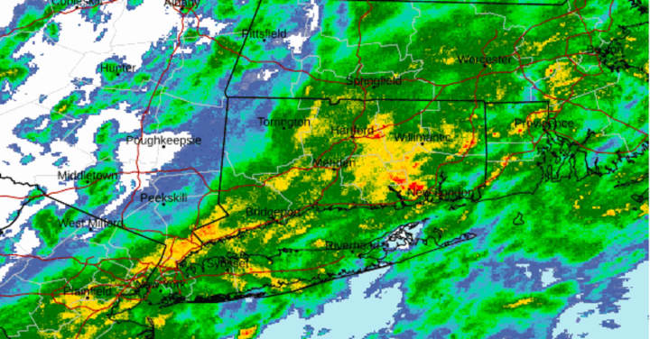
Precipitation which began overnight will continue during the day, with heavy rainfall at times, on Monday, Sept. 18. Afternoon thunderstorms are possible. The high temperature will be around 70 degrees.
About an inch of rainfall is expected before the system winds down early Monday evening.
It will be mostly cloudy overnight with the low temperature in the mid-50s.
Skies will gradually become clear, leading to a sunny day on Tuesday, Sept. 19 with a high temperature in the low-70s.
Look for more of the same on Wednesday, Sept. 20, Thursday, Sept. 21, and Friday, Sept. 22 with bright sunshine, high temperatures in the low 70s each afternoon, and overnight lows in the mid-50s.
It will be partly sunny on Saturday, Sept. 23 before the next storm system is expected overnight into Sunday, Sept. 24.
Check back to Daily Voice for updates.
Click here to follow Daily Voice Mount Pleasant and receive free news updates.


