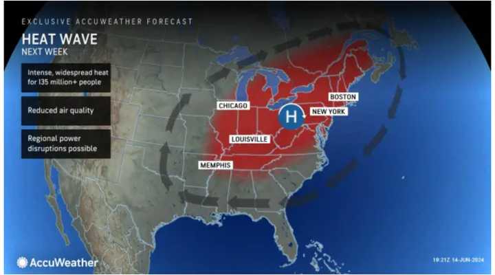
Temperatures will soar into the 90s in much of the Northeast starting on Tuesday, June 18. The mercury is expected to hit 90 degrees or higher each day, possibly through the end of the workweek.
A heat wave is defined as three or more consecutive days in which the temperature is 90 degrees or higher.
"The first heat wave of the season may start on Tuesday with peak heat index values above 95 possible," the National Weather Service said in a Hazardous Weather Outlook statement issued Saturday morning, June 15. "Heat will likely continue through the end of the week."
It will be bright and sunny Saturday, June 15, with a high temperature of around 80 degrees.
Look for more of the same for the second half of the weekend.
Father's Day on Sunday, June 16, will be a bit cooler, with temperatures topping out in the mid-70s and plenty of sunshine.
Temps will begin to climb on Monday, June 17, with a high in the mid to upper 80s and mostly sunny skies.
Tuesday, June 18 will be sunny with a high temperature generally in the low-90s.
The high temperature on Juneteenth, Wednesday, June 19 will again be in the low 90s, with sunny skies.
Thursday, June 20, marks the first day of summer. This year's solstice is at 4:51 p.m., and the temperatures will feel like it, with the high generally in the mid-90s.
Check back to Daily Voice for updates.
Click here to follow Daily Voice Mamaroneck and receive free news updates.
