Freezing drizzle and light snow overnight has created some slippery spots during the morning commute on Thursday, Feb. 28.
Clouds will give way to sun in the morning on a partly cloudy day with a high in the mid-30s and a wind-chill factor between 15 and 25.
Another quick-hitting system will bring a chance of snow and snow showers between 4 a.m. and 1 p.m. Friday, March 1 on a mostly cloudy day with a high in the upper 30s and wind-chill value between 20 and 30.
There's another chance of light snow between midnight and noon on Saturday, March 2, with little or no accumulation expected before the high temperature climbs to the upper 30s early in the afternoon on a mostly cloudy day.
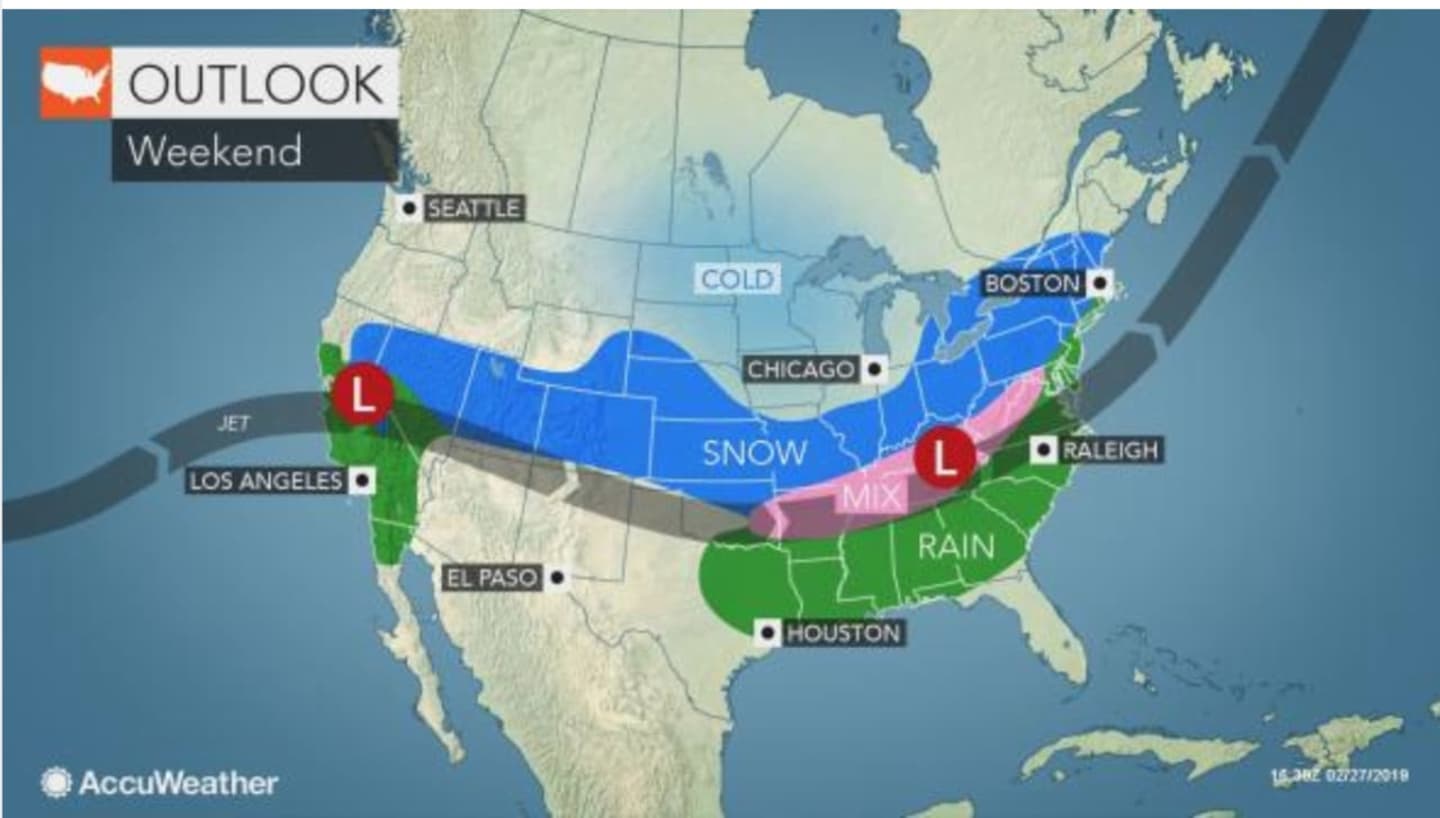
The more significant storm is expected to arrive late in the afternoon or early in the evening on Sunday, March 3, which will be partly sunny with a high near 40.
Snow is likely Sunday night before the system moves east Monday morning, March 4.
'The lingering cold air in its path will determine the extent and intensity of snow, ice and rain in the Eastern states from Sunday to early Monday," according to AccuWeather Meteorologist Courtney Travis.
The track and strength of the storm are still uncertain, so it's too early to project snowfall amounts.
Check back to Daily Voice for updates.
Click here to follow Daily Voice Lewisboro and receive free news updates.