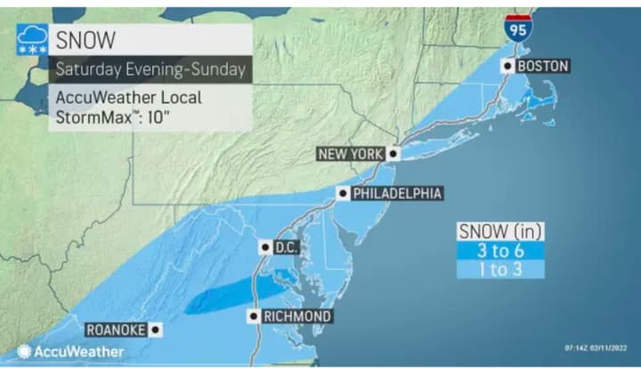
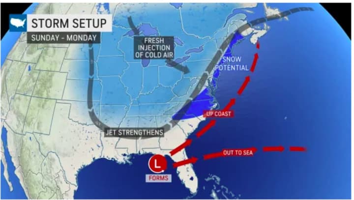
Areas in light blue in the first image above are expected to see between 1 to 3 inches of snowfall, according to AccuWeather.com. Some areas farthest south (in darker blue), could see 3 to 6 inches.
According to the National Weather Service, there will a chance for snow starting in the early morning hours on Sunday, shortly after midnight and continuing into the early afternoon.
Friday, Feb. 11 will be sunny and breezy with the high temperature in the mid to upper 40s and 20 mph wind gusts.
Saturday, Feb. 12 will see the mildest temperatures in weeks, with the high climbing to the low to mid 50s under cloudy skies prior to the possible arrival of the potential storm.
Sunday will also see a dramatic drop in temperatures with the high only around the freezing mark.
There's still uncertainty surrounding the potential strength and track of the storm.
Check back to Daily Voice for updates.
Click here to follow Daily Voice Lewisboro and receive free news updates.


