So now, get set for a bright, pleasant, and comfortable weekend.
Dew points will be about 5 to 10 degrees cooler Saturday, July 22, making it feel much less humid, according to the National Weather Service.
But wait there's more.
The Air Quality Index will be good too and no rain is expected through early next week.
High temperatures Saturday, and Sunday, July 23 will generally be in the low to mid-80s with plenty of sunshine on both days.
It will remain mostly sunny on Monday, July 24, and Tuesday, July 25 with high temperatures in the mid-80s both days.
High temperatures on Wednesday, July 26 will climb to around 90 degrees.
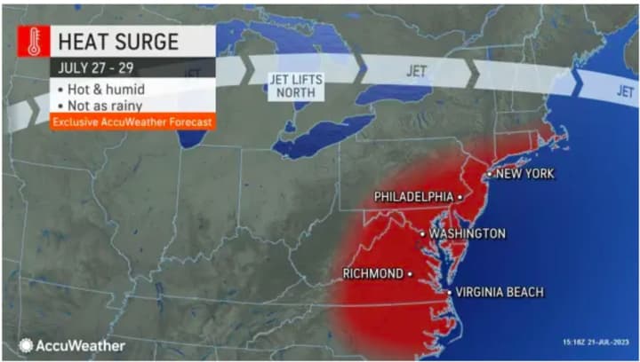
Current forecast models show the chance for a heat wave, which is defined as three straight days in which the high temperature hits 90 degrees or higher. (See the image above.)
"As the pattern evolves and the week progresses, temperatures will push into the 90s in a number of locations, especially in the major metro areas," according to AccuWeather Senior Meteorologist Joe Lundberg.
Check back to Daily Voice for updates.
Click here to follow Daily Voice Lewisboro and receive free news updates.


