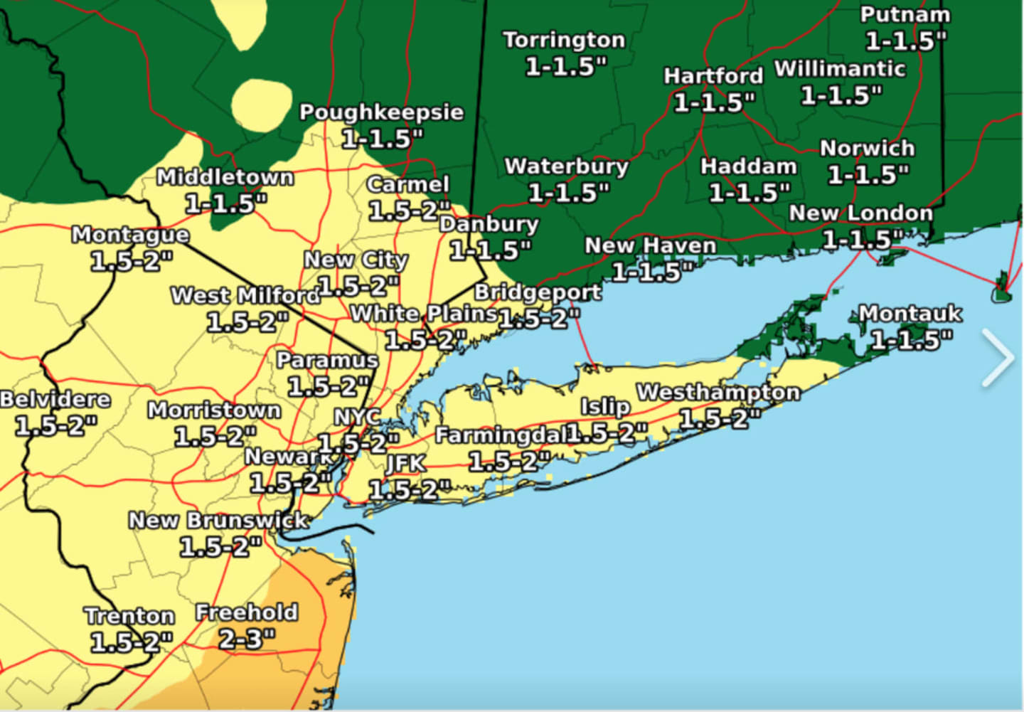

Most of the region will see about 1.5 inches of precipitation through Tuesday, May 14, with up to 2 inches in some spots. (See the first image above.)
Here's what to expect:
Sunday, May 12: Rain moved in from west to east overnight. It will continue on and off rain throughout a day that will feel more like it's mid-March than mid-May.
The high temperature will be 15 to 20 degrees below normal, struggling to reach the low 50s for most of the region, with highs only in the upper 40s in areas farther north. (See the second image above.)
Rain will taper off late in the afternoon, but light rain and drizzle are likely at times during the evening.
Up to a half inch of precipitation is possible throughout the day.
Monday, May 13: The wet weather sticks around to start the workweek on another cool, cloudy day with a high in the low 50s.
Rain should arrive after 10 a.m. with another half inch of rain possible before sunset. Look for more rain and showers during the evening with up to another half inch of precipitation.
Tuesday, May 14: Cloudy with a chance of showers and a high temperature in the mid 50s.
Wednesday, May 15: The cool, soggy stretch of weather ends. Wednesday will be partly sunny and warmer, with the high temperature in the low 60s.
Check back to Daily Voice for updates.
Click here to follow Daily Voice Harrison and receive free news updates.