In some areas farther north, 6 inches or more of snowfall is expected.
"The New York City area, as well as along the southern coast of New England, will be closer to the interface between the cold and warmer air, so a wintry mix is more likely to occur there," according to AccuWeather Senior Meteorologist and New England native Joe Lundberg.
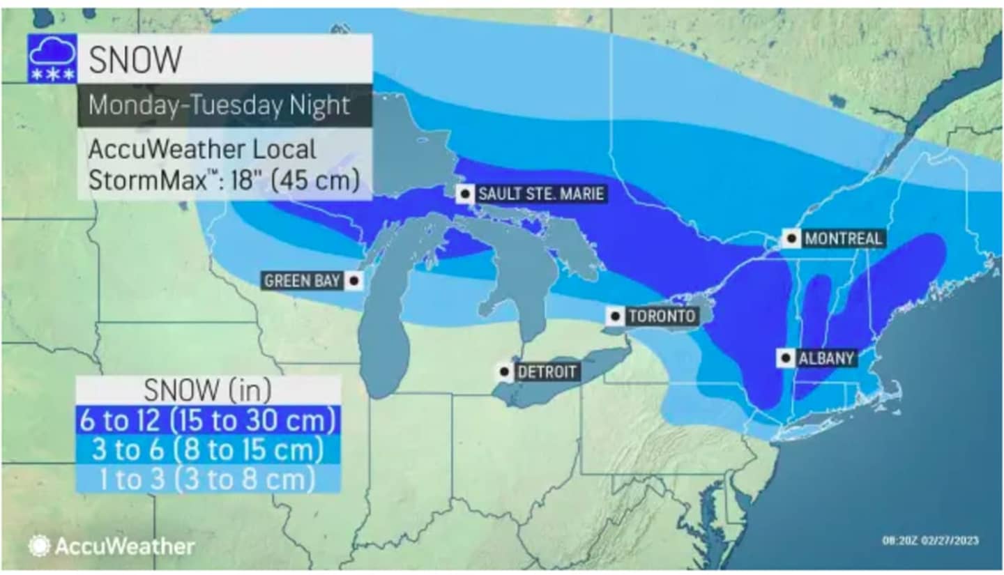
For a look at projected snowfall see the image above from AccuWeather.com: 1 to 3 inches (light blue), 3 to 6 inches (Columbia blue), and 6 to 12 inches (blue).
Snowfall is expected to arrive shortly after nightfall starting from west to east on Monday and could continue at times into around midday Tuesday before the high temperature climbs into the upper 30s on a mostly cloudy day, the National Weather Service says.
Temperatures will then increase during the middle of the week.
Wednesday, March 1 will be mostly sunny with a high temperature in the mid-40s.
The high temperature on Thursday, March 2 will reach the mid-50s with a chance for rain.
Check back to Daily Voice for updates.
Click here to follow Daily Voice Harrison and receive free news updates.