


Ida, the ninth-named storm of the 2021 Atlantic season, was packing a wind speed of 150 miles per hour as it closed in on the coastline. That put it just seven miles short of Category 5 status.
It remained a Cat 4 storm for hours after making landfall, with wind speeds falling to around 60 mph after major damage and destruction were reported.
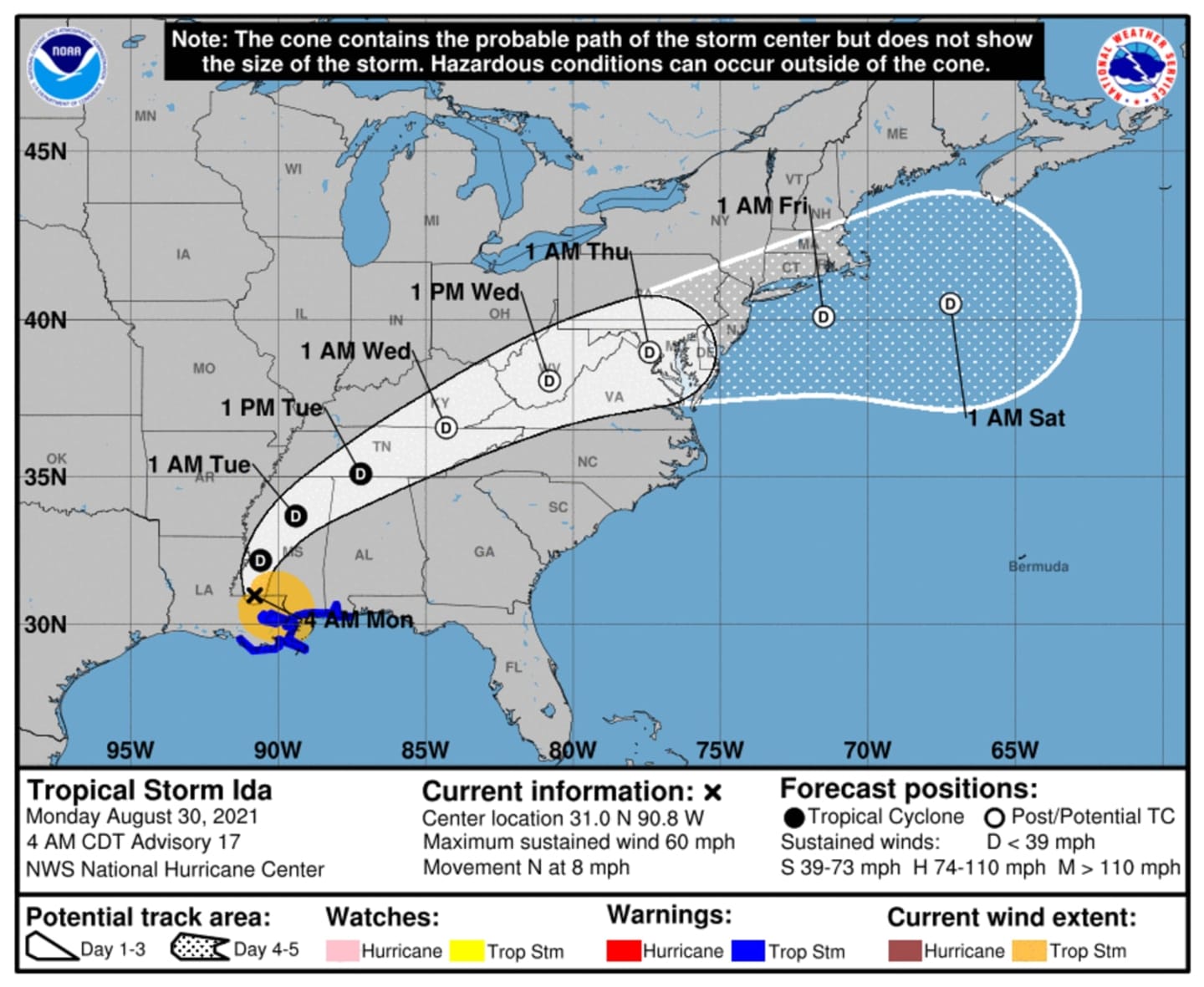
Now Tropical Storm Ida is expected to slowly move north and then northeast during the week, with its remnants arriving in this region on Wednesday, Sept. 1.
"The same front that will be steering Ida eastward after it makes landfall will also merge with the tropical system," AccuWeather Senior Meteorologist Dan Pydynowski said. "While it might be hard to find the center of Ida by the middle of the week, the transported tropical moisture will likely enhance rainfall from the Ohio Valley to the East Coast."
Rain from the system will arrive in the region early Wednesday afternoon and continue, with thunderstorms at times, through Thursday, Sept. 2.
Generally, 2 to 4 inches of rainfall is likely, with downpours at times. Wind speed should be around 20 mph.
"Remnants of Ida are expected to ride along a frontal boundary and affect the region Wednesday into Thursday," the National Weather Service said in a Hazardous Weather Outlook statement issued Monday morning, Aug. 30. "A period of moderate to heavy rainfall is now likely for the region Wednesday into a portion of Thursday. Flooding is a possibility, especially across urban and poor drainage areas. However, there still is some uncertainty as to where the heaviest rain will be.
- For the latest projected path for Tropical Storm Ida, see the first and second images above.
- For projected rainfall amounts for Hurricane Ida, click on the third image above.
- For a look at the levels of impact of Ida by region, click on the fourth image above.
This continues to be a developing story. Check back to Daily Voice for updates.
Click here to follow Daily Voice East Dutchess and receive free news updates.