Wednesday, Feb. 10 will be continued cold with areas of black ice in the morning and hazardous conditions on some untreated surfaces. It will be mostly cloudy with some filtered sun, a high temperature around 30 degrees and wind-chill values in the teens.
Light snow is possible overnight, with a trace to an inch of accumulation possible until around 10 a.m. Thursday, Feb. 11.
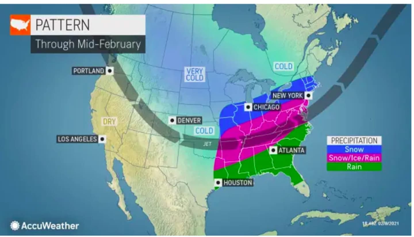
The storm will bring 6 to 12 inches of snow to southwestern Pennsylvania and several mid-Atlantic states on Thursday, which will be mostly sunny, with a high temperature near the freezing mark, and wind-chill values between 15 and 25 degrees in this region.
Friday, Feb. 12 will be mostly cloudy with the high temperature in the upper 20s and scattered flurries.
A partly sunny day with a high temperature in the upper 20s on Saturday, Feb. 13 will be followed by a potentially snowy stretch.
Valentine's Day, Sunday, Feb. 14 will be mostly cloudy with a high temperature hovering around the freezing mark and a chance for snow, a wintry mix, and rain. It's too early to predict possible snowfall amounts.
After a dry Presidents Day on Monday, Feb. 15, there will be another chance for snow on Tuesday, Feb. 16.
Check back to Daily Voice for updates.
Click here to follow Daily Voice East Dutchess and receive free news updates.