After a stretch of overnight lows at or below the freezing mark, there will be some moderation in temperatures after the end of Daylight Saving Time.
That will come at 2 a.m. Sunday, Nov. 7, when it's time to "Fall Back" and set clocks back an hour.
Saturday, Nov. 6 will be sunny and brisk with a high temperature in the low 50s. The overnight low will be right around the freezing mark.
After areas of frost in the morning Sunday, temperatures will rise to the mid 50s. The overnight low will be a bit higher than it's been the last several days - in the mid 30s.
That will lead to a day on Monday, Nov. 8 that will be sunny and a bit warmer, with a high temperature climbing to the low 60s.
The dry stretch of days will continue on Tuesday, Nov. 9, and Wednesday, Nov. 10 with a high temperature in the low 60s and mostly sunny skies both days.
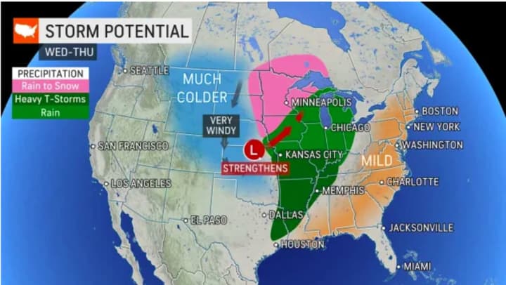
The major snowstorm, meanwhile, is expected to bring heavy snow in the upper Midwest Wednesday night into Thursday night, Nov. 11. (See image above.)
Check back to Daily Voice for updates.
Click here to follow Daily Voice East Dutchess and receive free news updates.


