
The current projected time frame for the storm is from early Monday evening, April 18 until around 8 a.m. Tuesday, April 19.
Rainfall totals from the system will be between 1 and 2 inches.
Wind gusts during the height of the storm will be upwards of 30 miles per hour, and as high as 50 mph in some spots.
"Gusty winds could blow around unsecured objects," the National Weather Service said in a Hazardous Weather Outlook statement. "Tree limbs could be blown down and a few power outages may result. Frost could kill sensitive outdoor vegetation if left uncovered."
After a mostly sunny morning, clouds will increase on Monday, April 18 and the high temperature will be in the low 50s.
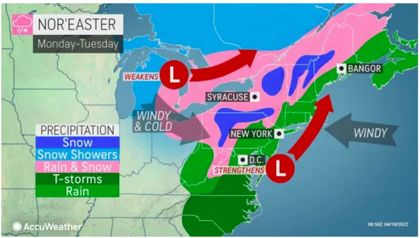
A look at projected snowfall totals from AccuWeather.com can be viewed by clicking on the second image above, with areas in light blue expected to see 1 to 3 inches of snowfall, areas in Columbia blue 3 to 6 inches, and areas in dark blue 6 to 12 inches.
A winter storm warning is in effect for counties in upstate New York and northern New England.
Check back to Daily Voice for updates.
Click here to follow Daily Voice Cortlandt and receive free news updates.