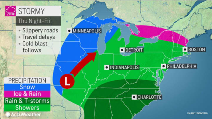
But a new, slow-moving storm system due to arrive on the second day of the new year will affect the region through the first half of the weekend.
Here's what to expect:
Wednesday, Jan. 1: Partly sunny and cold with the high temperature in the upper 30s but wind-chill values between 25 and 30 degrees. It will be clear overnight with the low temperature in the upper 20s.
Thursday, Jan. 2: The day will start out cold with morning wind-chill values between 20 and 30 degrees. But winds will lose strength by afternoon on a mostly sunny with the high temperature in the low to mid 40s. Clouds will increase later in the day into the evening, with rain arriving late and continuing occasionally overnight.
Friday, Jan. 3: Rain throughout the day and night with the high temperature in the mid to the upper 40s. Up to an inch of rainfall is possible through overnight Friday, with the temperature holding steady in the 40s.
Saturday, Jan. 4: Periods of rain and milder with the high temperature in the low to mid 50s. Rain will taper to showers by mid-afternoon. It will be mostly cloudy overnight with a low temperature in the mid 30s.
Sunday, Jan. 5: The stormy stretch ends as skies clear, leading to a partly sunny and colder day with the high temperature near 40 degrees. The overnight low will be in the upper 20s with partly cloudy skies.
Check back to Daily Voice for updates.
Click here to follow Daily Voice Cortlandt and receive free news updates.


