
The current time frame for the system is Monday night, Jan. 25 into Tuesday morning, Jan. 26.
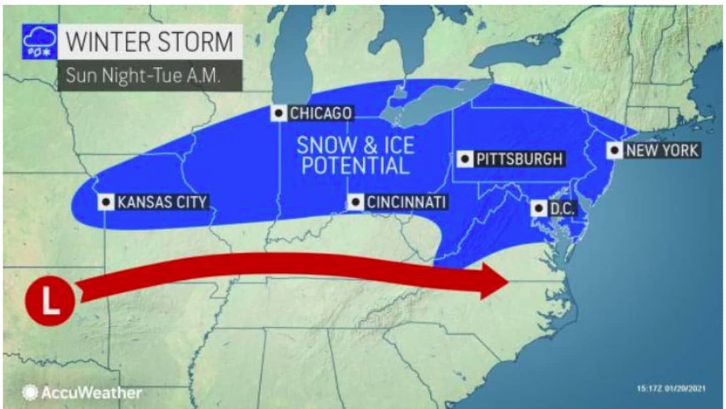
The storm is expected to cover an approximately 1,500-mile-long zone from parts of the midwest to eastern New York state and southern New England, according to AccuWeather. (See image above.)
Current models show the potential for up to a half-foot of snow, but the precise track of the storm is uncertain, and those projections could shift.
It will feel very much like winter in the days leading up to the storm.
Friday, Jan. 22 will be mostly sunny and breezy, with a high temperature around 40 degrees, and wind-chill values between 25 and 30. Winds will be between 8 and 15 miles per hour with gusts as high as 25 mph.
Wind-chill value temperatures will be in the teens and 20s over the weekend.
Saturday, Jan. 23 will be mostly sunny and blustery, with a high temperature around 30 degrees and wind-chill values between 10 and 15 degrees with winds between 15 and 25 mph and gusts as high as 36 to 38 mph.
Sunday, Jan. 24 will be mostly sunny with a high temperature around the freezing mark.
Prior to the storm's arrival Monday, it will be partly sunny during the day with the high temperature in the mid 30s.
It's too early to project more precise snowfall totals as there is uncertainty surrounding the track and strength of the storm.
Check back to Daily Voice for updates.
Click here to follow Daily Voice Cortlandt and receive free news updates.