Thursday, Dec. 27 will be ideal for traveling with sunny skies and a high again around 40 and wind-chill value also again between 25 and 35.
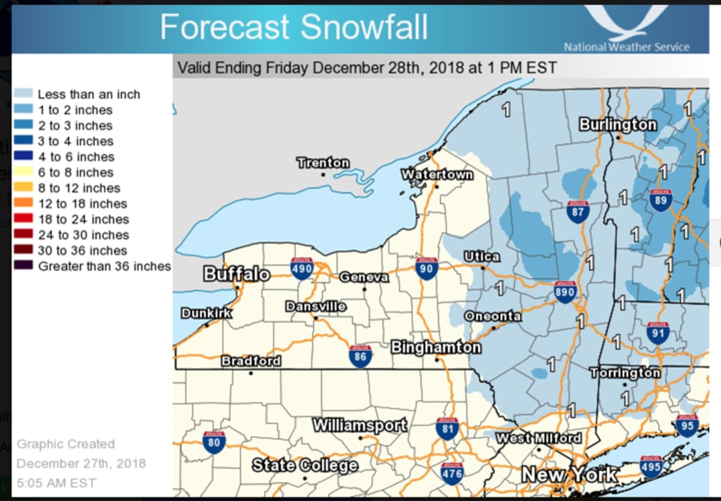
The storm system arrives late Thursday night. North of I-287 in New York and the Merritt Parkway in Connecticut, there is a chance of rain, snow and sleet between 10 p.m. and 1 a.m., followed by rain.
North of I-84, the wintry mix will change to rain a few hours later, with 1 inch of snowfall accumulation possible. (See first image above.)
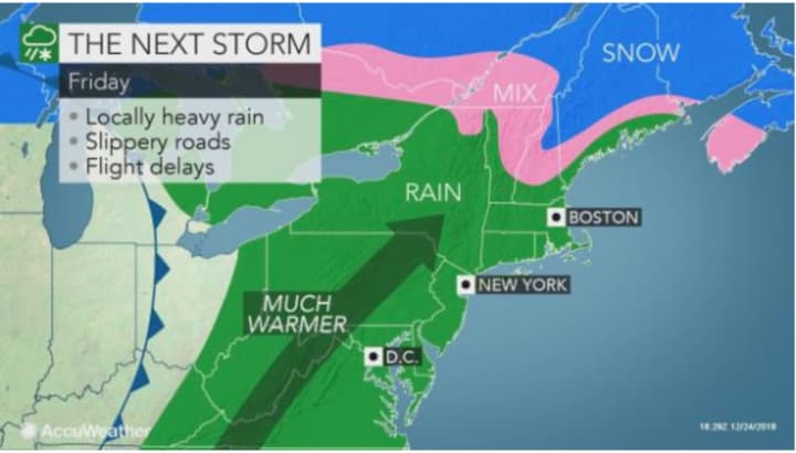
Areas farther south will see all rain.
The big change will be in the form of much warmer temperatures, starting overnight Thursday into Friday, Dec. 28.
Friday's high temperature will be between 52 and 54 degrees. There will be rain throughout the day with total accumulation of around 1 inch to 1.5 inches possible.
Rain will end by around 9 p.m. Friday with gradual clearing overnight, leading to a mostly sunny day on Saturday, Dec. 29. But then comes another change. The temperature will fall from the mid-50s to the low-40s during the afternoon.
That will lead to a much colder day on Sunday, Dec. 30 with the high only reaching about 34 degrees under sunny skies.
Check back to Daily Voice for updates.
Click here to follow Daily Voice Clarkstown and receive free news updates.