


The latest projected track for the Category 2 storm, packed with 100 mile-per-hour winds, still keeps it well off the US coast. (See first image above.)
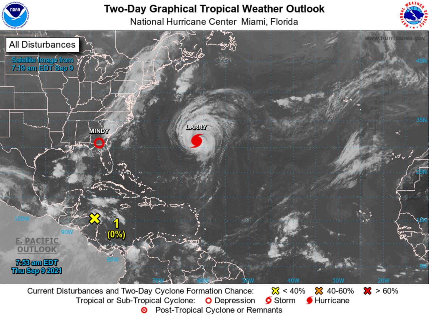
As of Thursday morning, Sept. 9, the center of Hurricane Larry was located over the central Atlantic Ocean about 240 miles east-southeast of Bermuda.
Larry is moving toward the north-northwest at around 16 mph, and a turn toward the north-northwest and north with an increase in forward speed is expected Thursday, with a faster northeastward motion expected by Friday, Sept. 10, the National Hurricane Center said.
On the forecast track, the center of Larry should pass east of Bermuda on Thursday, and move near or over southeastern Newfoundland Friday night or early Saturday morning, Sept. 11.
Impacts from Larry "will be far-reaching even though the storm may stay hundreds of miles away from the Atlantic beaches from Florida to Maine, said AccuWeather.
The storm is expected to bring strong rip currents, rough seas, and gusty winds, along with coastal flooding at times of high tide along the East Coast this week. (See the second image above.)
For a look at the current projected track for Larry, released by the NWS NOAA National Hurricane Center on Thursday morning, Sept. 9, click on the third image above.
Click on the fourth image above for the projected track for Larry from AccuWeather.
This continues to be a developing story. Check back to Daily Voice for updates.
Click here to follow Daily Voice Clarkstown and receive free news updates.