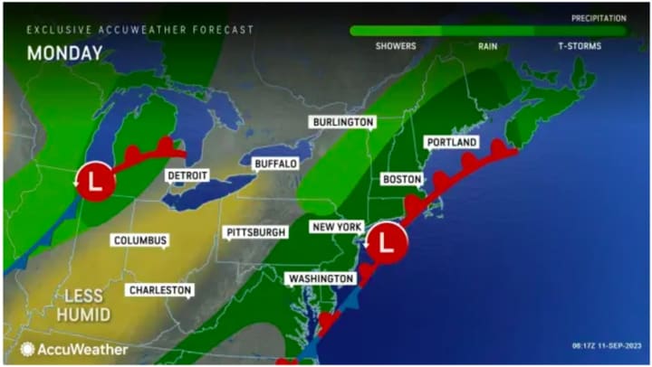
More potentially spotty, gusty thunderstorms are again on tap for the fourth straight day on Monday, Sept. 11 as a slow-moving frontal system maintains its hold on the region.
It will be mostly cloudy throughout the day with a high temperature in the upper 70s. The timing for scattered to numerous showers is in the afternoon and evening, according to the National Weather Service.
"What is left of a stalled boundary that has been parked over much of the region will linger through at least Monday," AccuWeather Senior Meteorologist Matt Benz said. "That means showers and thunderstorms will develop once again for Monday as a weak area of low pressure tries to develop off of Long Island and southern New England."
Isolated to scattered instances of flash flooding will be possible where the heaviest downpours fall on Monday, the weather service noted.
The outlook for Tuesday, Sept. 12 calls for partly sunny skies with a high temperature in the upper 70s. There could be scattered afternoon showers and a spotty storm, before the chance for precipitation increases Tuesday evening.
Wednesday, Sept. 13 will be mostly cloudy with more showers likely and a high temperature in the mid-70s.
The long stretch of unsettled weather will finally come to an end on Thursday, Sept. 14, which will be sunny and pleasant with more seasonable temperatures, with the high in the low 70s.
Look for more of the same, with bright, sunny skies and comfortable temps on both Friday, Sept. 15, and Saturday, Sept. 16.
Check back to Daily Voice for updates.
Click here to follow Daily Voice Clarkstown and receive free news updates.


