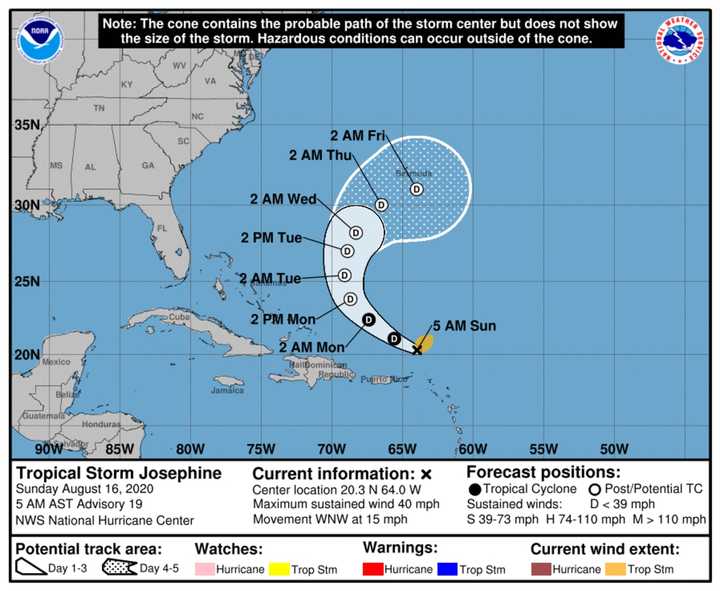
It has maximum sustained winds around 40 miles per hour, the National Hurricane Center said in a brand-new advisory issued Sunday morning, Aug. 16.
It's projected to bring 1 to 3 inches of rain to parts of the northern Leeward Islands, the Virgin Islands, and Puerto Rico. Isolated minor flooding is possible in Puerto Rico through Monday, Aug. 17.
As of daybreak Sunday, it was located about 155 miles north-northwest of the northern Leeward Islands in the northeast Caribbean.
A turn toward the northwest is expected by Sunday night, with Josephine forecast to slow down and recurve toward the north and northeast on Tuesday, Aug. 18 and Wednesday, Aug. 19.
On Friday, Aug. 14, Kyle became the 11th named tropical system of the 2020 Atlantic hurricane season. A day later, it was downgraded to a post-tropical cyclone and is still far off the East Coast of the continental United States, and continues to pose no threat.
For a look at Josephine's projected five-day track, see the first image above.
Josephine became the earliest appearance of the "J' storm since the satellite era began in 1966. The previous record was held by Tropical Storm Jose on Aug. 22, 2005.
Hurricane turned Tropical Storm Isaias (pronounced "ees-ah-EE-ahs") became the earliest storm to begin with an "I" on record. The previous record was set on Aug. 7, 2005.
The first hurricane of the 2020 season, Hannah, became the earliest storm with an "H" name by nearly two weeks.
Check back to Daily Voice for updates.
Click here to follow Daily Voice Chappaqua and receive free news updates.
