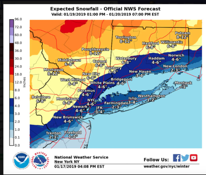
A total accumulation of between 3 to 7 inches of snowfall is expected for most of the region, with up to 12 inches farthest north. (See second image above.)
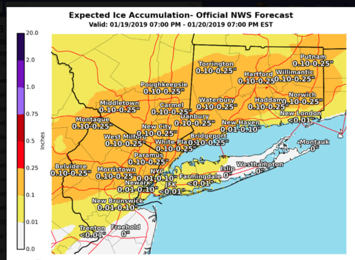
Ice accumulations of one-tenth to one-quarter of an inch are expected. (See third image above.)
The highest snowfall totals will be across Orange and Putnam counties, according to the National Weather Service.
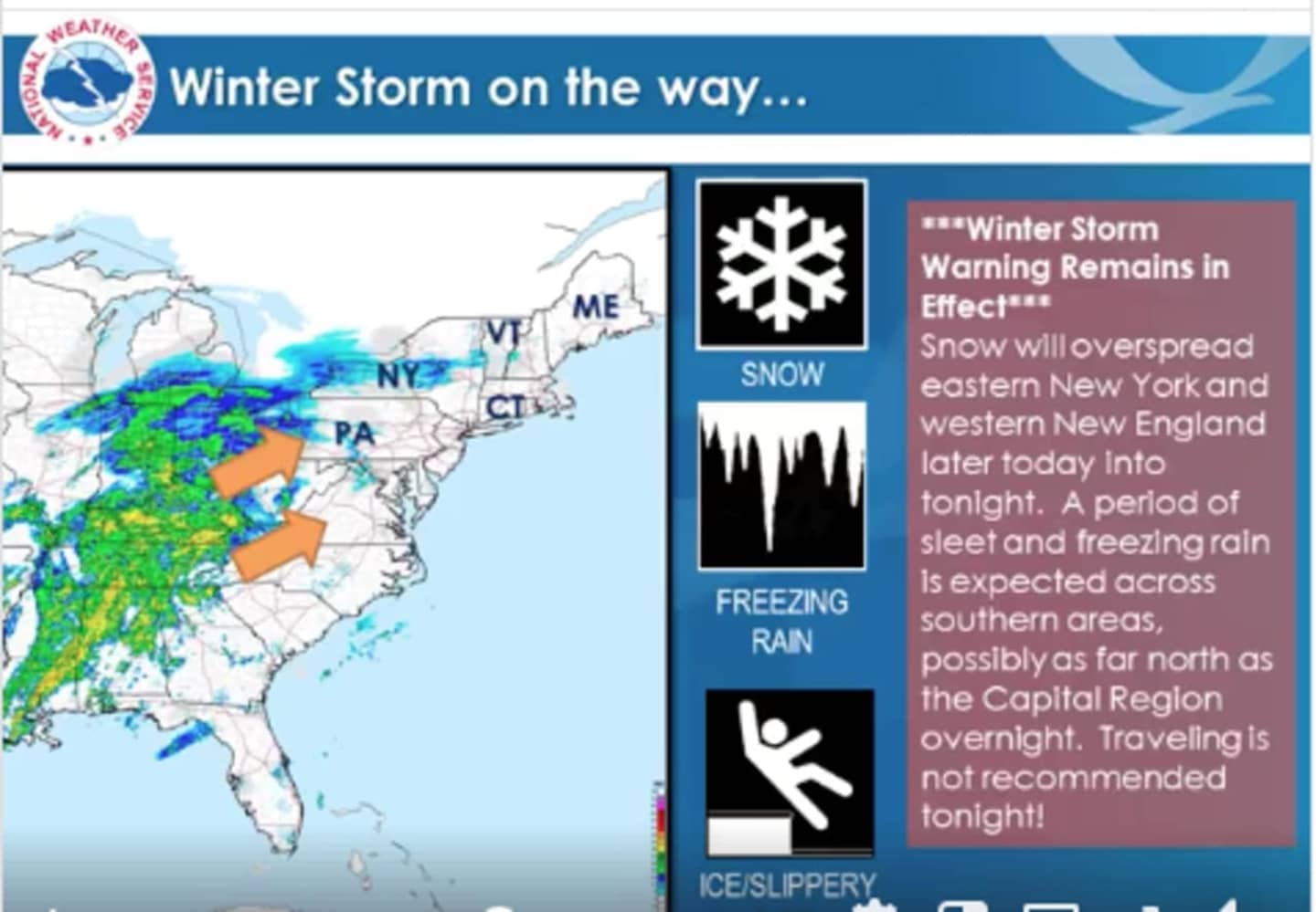
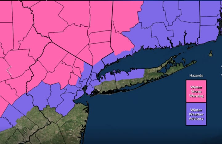
A Winter Storm Warning is now in effect until 6 p.m. Sunday, Jan. 20 for areas north of I-287 and the Merritt Parkway. (Shown in pink in the first image above. A Winter Weather Advisory covers Southern Westchester and coastal Fairfield County.
Snow will arrive Saturday evening. With roads becoming snow and ice covered, travel conditions will be hazardous.
Gusty winds of up to 30 mph on Sunday, Jan. 20, along with snow, and ice accumulation may bring down tree limbs and power lines and could lead to widespread outages.
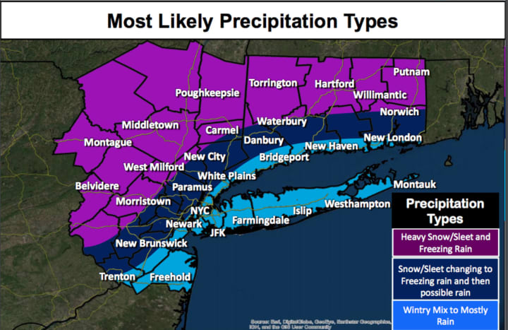
Precipitation will be the heaviest overnight into Sunday and gradually end late Sunday afternoon. Heavy rain will mix in at times during the afternoon.
The storm will be followed by a flash freeze-up as a blast of Arctic Air will bring the coldest air of the season.
The overnight low Sunday night into Martin Luther King Jr. Day, Monday, Jan. 21, will be between zero and 5 degrees. Wind-chill overnight values will be between -5 and -15.
Monday will be mostly sunny, icy and frigid, with a high temperature in the lower teens.
Tuesday, Jan. 22 will be mostly sunny with a high in the upper-20s.
Check back to Daily Voice for updates.
Click here to follow Daily Voice Bronxville and receive free news updates.