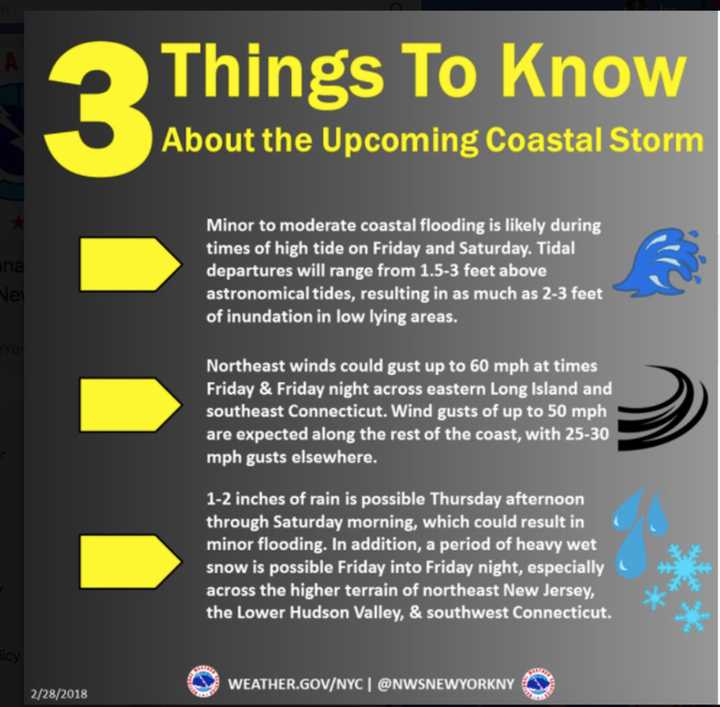
As a Nor'easter closes in on the area, a Flood Watch has been issued by the National Weather Service.
The watch covers northeast New Jersey and the Hudson Valley.
Smaller rivers and streams across the area will be most vulnerable to the possibility of flooding. In addition, poor drainage urban flooding is possible and may be enhanced by the effects of coastal flooding, according to the National Weather Service.
A Flood Watch means there is a potential for flooding and those living in areas prone to flooding should be prepared to take action should flooding develop.
In addition to the Flood Watch, a High Wind Watch has been issued for Southern Westchester and Southern Fairfield.
Damaging winds will blow down trees and power lines and widespread power outages are expected, the National Weather Service said. Travel will be difficult, especially for high profile vehicles.
A High Wind Watch means there is the potential for a hazardous high wind event. Sustained winds of at least 40 mph or gusts of 58 mph or stronger may occur.
Check back to Daily Voice for updates on the storm.
Click here to follow Daily Voice Bronxville and receive free news updates.
