It will remain unsettled on Thursday, Feb. 23, with some lingering precipitation at times as the storm pushes off the coast, according to the National Weather Service.
For a look at precipitation types, see the first image above from AccuWeather.com.
Skies will gradually clear overnight, leading to a mostly sunny day on Friday, Feb. 24. It will be blustery during the day and into the evening.
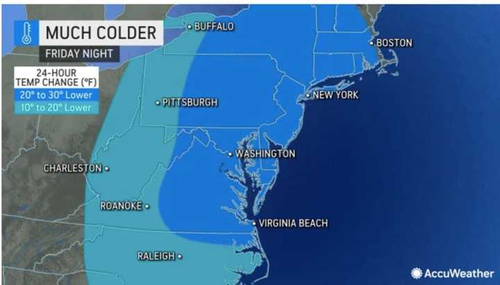
It then turns much colder late Friday with temperatures dropping from the mid 40s to the mid-teens into the first half of the weekend. (Click on the second image above.)
Wind gusts will be as high as 30 miles per hour Saturday morning, Feb. 25 on a day in which the high temperature will be right around the freezing mark, the National Weather Service says.
There will be a chance of snow showers Saturday afternoon into Saturday night. (Click on the third image above.)
Sunday, Feb. 26 will be mostly cloudy with a high temperature in the mid 40s.
The next chance for snow will come on Monday afternoon, Feb. 27 into the late evening, especially in areas farther north and inland.
It's too early to project potential snowfall amounts from that system.
Check back to Daily Voice for updates.
Click here to follow Daily Voice Briarcliff and receive free news updates.


