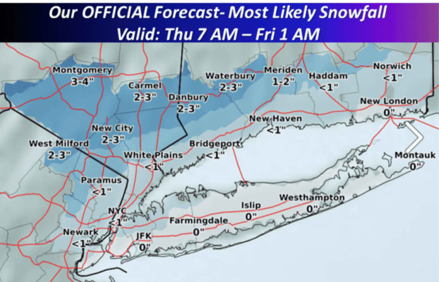

The Lower Hudson Valley will be spared from any significant accumulating snowfall from the Nor'easter moving through the area, but motorists should be prepared for slippery conditions during Thursday's morning commute.
There is a 20 percent chance of light snow after 1 a.m., with snow and sleet likely before 9 a.m., according to the National Weather Service. The precipitation will be all liquid after 9 a.m. as the day's high temperatures reaches the low 40s. The chance of precipitation is 100 percent. Snow and sleet accumulation of less than a half-inch are possible.
Rain is likely, mainly before 10 p.m., Thursday night. The overnight low will be in the upper 20s, with wind-chill values between 20 and 25.
There is a chance of snow showers after 1 p.m. Friday during a mostly sunny day with a high in the upper 30, but the wind-chill factor making it feel more like between 20 and 25 degrees. The overnight low Friday into Saturday will be in the mid 20s.
New Year's Eve Day will be mostly sunny with a high in the mid to upper 30s. There is a 30 percent chance of some snow just as the ball drops ushering in 2017.
New Year's Day, on Sunday, will be mostly sunny with a high in the mid 40s.
Check back to Daily Voice for updates.
Click here to follow Daily Voice Armonk and receive free news updates.