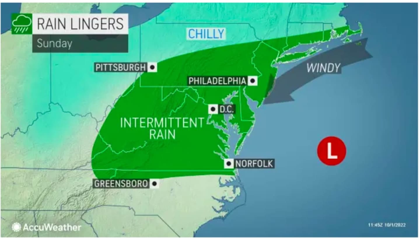
Sunday, Oct. 2 will be cloudy throughout the day with a high temperature of around 60 degrees and intermittent rainfall at times, especially in the early afternoon, mainly in areas farther south, especially in New York City and surrounding areas.
A look at those areas is shown in the image above, including where coastal flooding is possible.
"Widespread minor flooding of vulnerable areas is expected near the waterfront and shoreline, including roads, parking lots, parks, lawns, and homes and businesses with basements near the waterfront," the National Weather Service said in a Hazardous Weather Statement issued early Sunday.
The blustery conditions will continue on Sunday, with wind gusts as high as 30 mph.
More rain is possible at times Sunday evening and overnight into Monday morning, Oct. 3.
It will remain mostly cloudy on Monday, but will be dry for most of the day, with a chance of scattered showers in the afternoon.
Winds will remain strong with gusts of 20 mph or more, and it will remain raw with a high temperature in the upper 50s.
It will stay cloudy on Tuesday, Oct. 4 with a high temperature of around 60 degrees. There is a slight chance for popup showers.
Skies will gradually clear overnight, leading to a mostly sunny day on Wednesday, Oct. 5, with the high temperature climbing to the upper 60s.
Check back to Daily Voice for updates.
Click here to follow Daily Voice Armonk and receive free news updates.