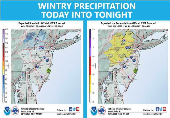
The first was snow, and it was making its way across North Jersey and Southeastern Pennsylvania as of 8:15 a.m. Sunday, the National Weather Service said.
Between two and four inches of snow and sleet were possible in North Jersey and The Poconos before noon, while rain was expected across Central and South Jersey.
The second round of precipitation was expected to feature more rain than snow in the early afternoon and evening, coating parts of eastern PA and northwestern NJ in ice.
Up to a tenth of an inch of ice from freezing rain was possible. See map below.
Mostly rain was expected across Central and South Jersey, and Philadelphia, where temps would be in the high 30s for most of the day before dropping into the low- to mid-30s in the evening.
There was a chance rain could mix with snow in those areas after 11 p.m., the NWS said.
Click here to follow Daily Voice Paramus and receive free news updates.
