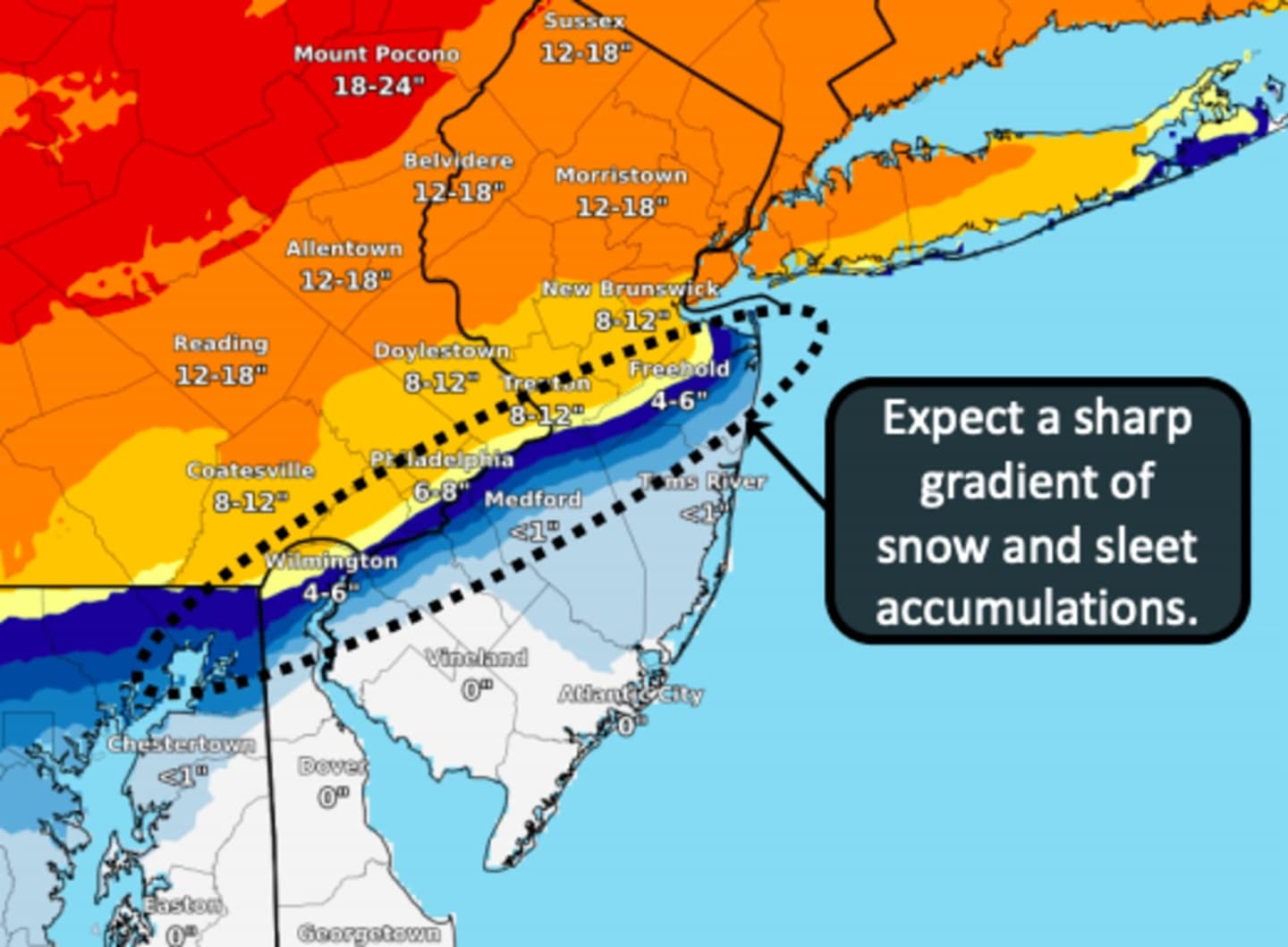
Precipitation will begin early Wednesday afternoon in South Jersey, then head north to Central Jersey and Philadelphia, where 6 to 12 inches of snow are predicted, the National Weather Service says.
Strong winds and heavy sleet were likely across South Jersey and Philadelphia, with a chance of rain leading along the Jersey Shore. Coastal flooding was possible, especially late Wednesday night and early Thursday morning, meteorologists say.
Snowfall is expected to begin in North Jersey and Southeastern Pennsylvania around 3 p.m. Wednesday, with anywhere between 12 and 18 inches of snow were possible into Thursday, forecasters say.
Multiple hazards are expected Wednesday evening due to gusty winds up to 40 miles per hour creating blizzard-like and treacherous travel conditions, the NWS says.
Outages were likely across North Jersey.
A Winter Storm Warning is in effect for all of southeastern Pennsylvania, and most of Central and North Jersey.
The Poconos could get slammed with up to two feet of snow.
Click here to follow Daily Voice North Passaic and receive free news updates.