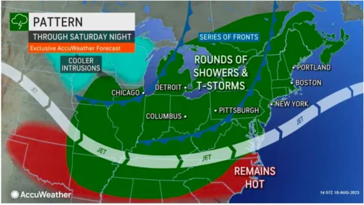
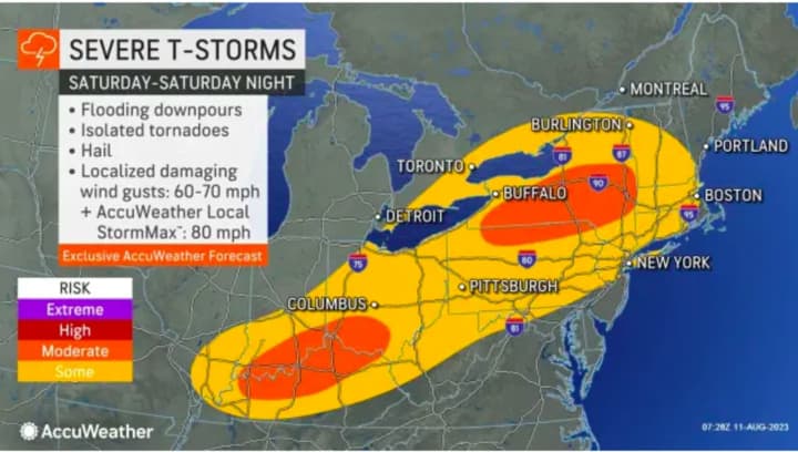
The time frame for scattered storm activity moving from the west to the east on Saturday, Aug. 12 is from about the middle of the afternoon through the evening when the chance will increase. (See the first image above from AccuWeather.com.)
Damaging winds of 60 miles per hour or more and large hail of about 1-inch in diameter are the main threats, the National Weather Service said in a statement early Saturday morning.
"An isolated tornado is also possible," the statement added, noting there is also a chance for flash flooding with rainfall rates of 1 to 2 inches an hour possible in some spots where there are the heaviest downpours.
Saturday has started off with a mix of sun and clouds on a day in which the high temperature will be in the mid-80s.
After the system pushes through, the second half of the weekend will be mostly sunny on Sunday, Aug. 13 with a high temperature in the mid-80s, except in eastern New England, where there could be pop-up storms.
It will remain mostly sunny during the day on Monday, Aug. 14 with a high temperature generally in the low 80s before more unsettled weather is expected to return overnight into Tuesday morning, Aug. 15.
Click here to follow Daily Voice Northern Valley and receive free news updates.


