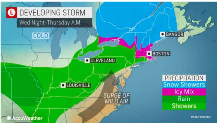
With a stretch of dry days upcoming, attention is now turning to a coast-to-coast system that is now due to arrive in the Northeast earlier than originally expected, on Thursday, Jan. 12. (See the first image above from AccuWeather.com.)
Mainly rain (shown in green) is expected in much of the region Thursday into Friday, Jan. 13 with a wintry mix possible farther inland (pink) and snow in some parts of northern New York and New England (areas in blue in the second image above).
"At this time, communities from the Great Lakes into northern New York, central and northern New England, and even southern Canada have the best chance for accumulating snow late Thursday into Friday," AccuWeather Senior Meteorologist Dan Pydynowski said.
Skies will gradually become partly to mostly sunny on Monday with a high temperature in the low 40s and calm winds, according to the National Weather Service.
It will be clear and cold overnight, leading to a brisk day on Tuesday, Jan. 10, with wind-chill values in the 20s even though the high temperature will be around 40 degrees under partly sunny skies. Wednesday, Jan. 11 will continue to be cold with partly sunny skies.
The storm system is now expected to arrive sometime in the early to mid-afternoon on Thursday, Jan. 12 in the form of rainfall with a high temperature in the mid 40s. Precipitation is then expected to continue at times into Friday night.
Click here to follow Daily Voice Mahwah-Ramsey and receive free news updates.


