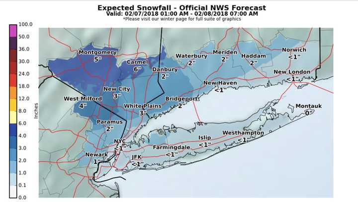
Precipitation is expected to start as all snow for the entire region early Wednesday morning before quickly turning to sleet, freezing rain and then rain in and around New York City and along the coast.
Farther inland, and especially north and west, snow will likely accumulate through the morning and early afternoon.
The latest forecast predicts temperatures rising into the mid-30s for much of the area in the early afternoon, meaning a changeover to rain south of I-84, where anywhere from 1 to 3 inches of accumulation is now expected. (See image above.)
North of I-84, accumulations of 4 to 8 inches are expected.
But farther north, including parts of Putnam, Dutchess and Orange counties, the high will struggle to hit the freezing mark and snow will continue through late afternoon.
Motorists should expect travel delays for both the Wednesday morning and Wednesday evening commutes.
Thursday will be a mostly sunny day with a high in the low 30s.
A slight change in the track of the storm will impact precipitation types, and snowfall and ice accumulation amounts.
Click here to follow Daily Voice Mahwah-Ramsey and receive free news updates.
