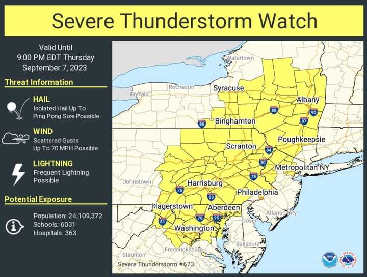
The watch is in effect until 9 p.m. Thursday, Sept. 7 across DC, MD, NJ, PA, and VA.
Potentially dangerous straight-line wind gusts are the primary threat, with potentially damaging hail also possible, according to the National Weather Service. Localized heavy rainfall and lightning are also possible.
The storms are expected to break the extreme heat, but could stick around until Tuesday, Sept. 12, AccuWeather says.
"Locations right along the Eastern Seaboard, like New York City, Philadelphia and Washington, D.C., can expect the wet weather to wait until late Thursday night or Friday," AccuWeather says.
"Daytime temperatures are forecast to rise into the 90s in many areas along Interstate 95 through Friday. With high humidity factored in, AccuWeather RealFeel® Temperatures could climb to around 100 F."
Click here to follow Daily Voice Mahwah-Ramsey and receive free news updates.

