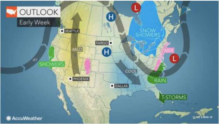
There is still much uncertainty surrounding the path of a possible Nor'easter that could affect the area early in the workweek, but the time frame for the storm has changed.
The storm, if it pans out, would arrive later than originally predicted, with possible impact now Monday night into Tuesday morning for a region that already has been battered by two other Nor'easters this month.
According to the latest forecast from the National Weather Service, there is now a 40-percent chance of snow Monday night in the tristate area. The snow chance continues through noon on Tuesday.
"At this time, we feel there is a better than 50/50 percent chance the worst of the storm will stay to the south and east of New York City," according to AccuWeather Senior Meteorologist Dave Dombek.
In order for the storm to turn northward and produce a broad swath of heavy snow in the area, the jet stream will have to dramatically change position to allow the storm to back closer to the coast, AccuWeather said.
A much clearer indication of the storm's path is expected on Sunday.
Check back to Daily Voice for updates.
Click here to follow Daily Voice Hackensack and receive free news updates.
