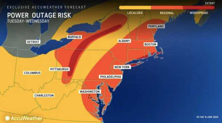
Between 1 and 3 inches of rain is expected across the state with up to 65 mph winds that could cause power outages and uprooted trees, according to the National Weather Service.
Towns along the Atlantic coast line and along major rivers and bays were expected to see significant flooding, even more so due to runoff from the melting snow from last weekend's storm, the NWS said.
Precipitation could begin as snow for the western portion of the state but ultimately will be heavy rain, beginning from 3 p.m. and continuing heavily until midnight, the weather service said in its morning briefing.
The heaviest rain if focused across northern NJ and northeast PA "due to very strong southeast flow into the higher terrain," the NWS writes.
AccuWeather noted a major risk of flash-flooding and widespread power outage risk.
The State of Emergency goes into effect at 5 p.m. Here's all you need to know on what it means.
Click here to follow Daily Voice Garfield-Lodi and receive free news updates.
