That time frame for that system is early Wednesday morning, Dec. 8, into Wednesday evening.
If the storm, which will be moving from west to east, tracks farther north, it could "bring heavier snow to inland portions of the Northeast and mainly rain mixed with some snow to coastal areas," AccuWeather Meteorologist Alex DaSilva said.
It's too early to predict potential snowfall amounts.
A second scenario would take the track south and see if shift out to sea, resulting in lighter snow showers across the interior Northeast, says AccuWeather.
For a look at the two scenarios, see the first image above.
But before that system sweeps through, another storm bringing rain and strong wind with gusts up 50 miles per hour will be followed by a sharp drop in temperatures, setting the stage for the potential for the midweek storm being a snowmaker.
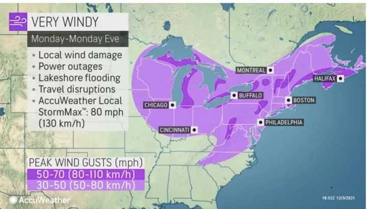
That first storm, a frontal system, will arrive Monday morning, Dec. 6. Most of the region will see 30 to 50 mph wind gusts on Monday (light purple in the second image above) with 50 to 70 mph gusts in some spots (dark purple), according to AccuWeather.
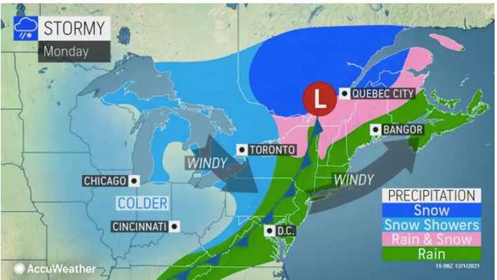
Precipitation from that storm will mainly be rain (in green in the third image above).
Sunday, Dec. 5 will be partly sunny and brisk during the day with a high temperature in the mid to upper 40s before the storm system arrives overnight.
Showers are expected to arrive just before daybreak on Monday and continue through the late morning on a mostly cloudy day with a high temperature climbing to around 60 degrees. Winds will pick up as the day goes on with speeds of 12 to 18 mph with the stronger gusts.
Scattered showers are expected to linger through the early overnight hours on Tuesday, Dec. 7.
Skies will then clear on Tuesday as temperatures plummet, with a high of only about 40 degrees on a mostly sunny day.
Check back to Daily Voice for updates.
Click here to follow Daily Voice Fair Lawn-Glen Rock and receive free news updates.


